USSR Ministry of Defense
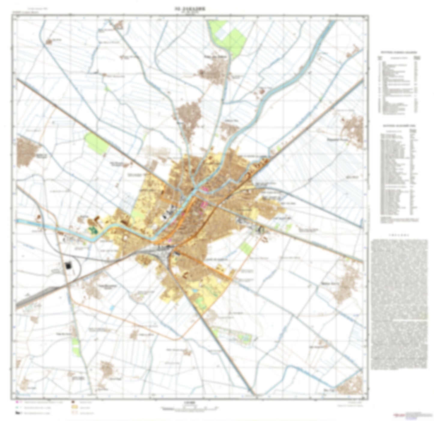
Zagazig (Egypt) - Soviet Military City Plans
Zagazig (Egypt) - Soviet Military City Plans
Regular price
$49.95 USD
Regular price
Sale price
$49.95 USD
Unit price
per
Shipping calculated at checkout.
Couldn't load pickup availability
- SKU: SUAA-ZAGAZIG-P
- During the Cold War and before easy access to high-resolution satellite imagery, The Soviet Military was secretly mapping the entire world. These aesthetically striking maps are beautiful down to the last detail and fantastic wall art and until now, have rarely been viewed or available to outsiders. This series has been covered by Wired Magazine and Greg Miller in his book, "All Over the Map: A Cartographic Odyssey". This map is part of the Soviet City Plans Series presented by East View, which has the largest collection of Soviet Military City Plans in the world. The Soviet Military City Plan(s) of Zagazig (Egypt) is one in a series of highly detailed topographic city maps developed by the USSR Ministry of Defense during the Cold War era. These collectable, high resolution print-on-demand editions are delivered on premium, acid-free, matte paper. This item is sheet number 1 in a set of 1 sheet(s) for Zagazig Populated Places: 'Izbat 'Umran, 'Izbat Abu Hilal, 'Izbat al Mashhadi, 'Izbat al Qadi, 'Izbat an Najdi, 'Izbat as Subki, 'Izbat ash Shabakat, 'Izbat Bahjat, 'Izbat Hasan Agha, 'Izbat Imam, 'Izbat Lukshah, 'Izbat MuHammad al 'Attar, Az Zaqaziq, Banayus, Hirriyat Raznah, Kafr 'Abd al 'Aziz, Kafr Abu Hakim, Kafr al 'Abid, Kafr al AHrar, Kafr al Hamam, Kafr al Husr, Kafr al Isharah, Kafr an NahHal, Kafr az Zand, Kafr MuHammad Husayn, Manshiyat as Sadat, Markaz az Zaqaziq, Qaryat al Ghar, Shubak Bastah Landmarks and Natural Features: Kulliyat at tibb al Baytari
- Subtype: City Plan
- Language: Russian
- Publication Date: 1978-06-01
- Scale: 1:10,000
- Countries Covered: Egypt
- MPN: ZAGAZIG
- Folded Size: N/A
- Unfolded Size: 32" (W) x 31.1" (H)
- Weight: 4.8 oz