Raven Maps
Yosemite National Park Elevation Tints Fine Art Print Map
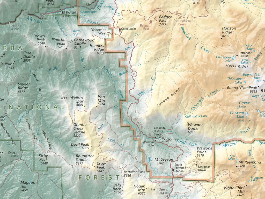
Yosemite National Park Elevation Tints Fine Art Print Map
Couldn't load pickup availability
- SKU: PODRP_YOSEMITE_ELEV_16X20_WA
Explore the spectacular topography of Yosemite National Park with this beautiful fine art print map. From the snowcapped summits of the High Sierra that rise above Tuolumne Meadows to the banks of the Merced River as it flows through Yosemite Valley, our classic hypsometric tints combine with shaded relief to showcase the glacially-sculpted landscapes that define the park. Over 1,200 hand-placed labels mark key features in and around Yosemite including mountains, lakes, roads, visitor centers, giant sequoia groves, and waterfalls. Trails are shown as they wind through the wildernesses found inside and outside the park, and both the Pacific Crest Trail and the John Muir Trail are labeled.
Whether you’re dreaming about your next trip to Yosemite Valley or reminiscing about past explorations in the park's high country, this stunning map serves as both a reference and an inspiration for adventure in Yosemite National Park.
- Type: Flat Map
- Subtype: Wall Art
- Language: English
- Scale: 1:180,000
- Regions Covered: North America, Western U.S.
- Countries Covered: United States
- States Covered: California
- MPN: PODRP_YOS_NP_ELEV
- Folded Size: N/A
- Unfolded Size: 16" (W) x 20" (H)
- Finish: Regular Paper