GH Smith & Son
WWI: Zillebeke (Belgium) Trench Map
WWI: Zillebeke (Belgium) Trench Map
Regular price
$12.99 USD
Regular price
Sale price
$12.99 USD
Unit price
per
Shipping calculated at checkout.
Couldn't load pickup availability
- SKU: GHS_ZILLEBEKE_16
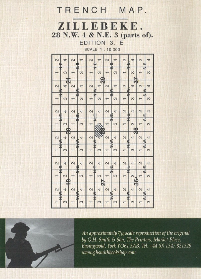
- Zillebeke (28 NW 4 & NE 3 - ed. 3E) in a series of British Army trench maps from the WWI, reproduced by G.H. Smith & Son at approximately 7/10th of the original scales quoted against each title. The map shows trenches corrected to 2.9.1916 and covers an area from Ypres to Polygonne de Zonnebeke and from Bellewaarde Ridge to Battle Wood, including Westhoek and Polygon Wood. Maps in this series show both the British and the enemy trenches. Several titles also indicate supply and ammunition dumps, machine gun and trench mortar emplacements, observation posts, etc. Most titles are annotated with a specific date when they were prepared and include on the reverse a glossary of terms used on the map. Some also include additional information on the regiments and/or individual solders connected with that particular part of the front.
- Type: Folded Map
- Subtype: Historical
- Language: English
- Publication Date: 1916-09-02
- Scale: 1:10,000
- Regions Covered: Europe, Western Europe
- Countries Covered: Belgium
- Folded Size: 4.33" (W) x 5.9" (H)
- Unfolded Size: 23.62" (W) x 24.4" (H)