Inspirit Cartographics
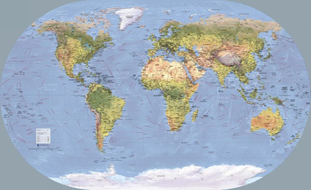
World Wall Map of Global Shipping Routes
World Wall Map of Global Shipping Routes
Couldn't load pickup availability
- SKU: INS_WOR_SHIP_WA
This is an intriguing map composed using a bright color palette. The map bears resemblance to a world map painting and looks wonderful for home and office walls. Countries, capitals, cities and international boundaries could be seen on the map. High-definition terrain topography provides an enhanced view of the worlds high-end regions, lowlands, valleys, oceans, poles, grasslands and more.
This world map with major cities and countries shows the major shipping routes, undersea features, mountain peaks, geographic regions, and more.
Major shipping routes for global trade:
The English Channel: Known as the busiest shipping lane in the world, it separates England from France and connects the North Sea and the Atlantic Ocean.Strait of Malacca: The Malacca Strait is a narrow 550 miles and is the shortest route between the Pacific and Indian oceans. It links major Asian economies such as India, Indonesia, Malaysia, Singapore, China, Japan, Taiwan and South Korea.
Panama Canal: An artificial passageway that reduces transit times between the Pacific and Atlantic oceans. It’s approximately 50 miles long, 10 miles wide and takes roughly 10 hours to travel
Suez Canal: Suez Canal is the shortest maritime route between the Atlantic and Indian oceans.
Bosphorus Strait: The Turkish Strait of Bosphorus links the Black Sea to the Marmara Sea and ultimately connects it to the Atlantic Ocean. It forms a boundary between Europe and Asia and is internationally significant for oil, commercial and military trade.
Saint Lawrence Seaway: This shipping lane is considered to be the most important shipping lane in North America that connects the Atlantic Ocean with the Great Lakes.
Other important features on the map are capital cities, major cities, international boundaries, state/provincial borders. The map also highlights land cover - glacier, tundra, highlands, forest, savannah, herbaceous and desert area.
- Type: Flat Map
- Subtype: Transportation
- Scale: 1:39000000
- Regions Covered: World
- Folded Size: N/A
- Unfolded Size: 54" (W) x 33" (H)