USSR Ministry of Defense
Wellington (New Zealand) - Soviet Military City Plans
Wellington (New Zealand) - Soviet Military City Plans
Regular price
$49.95 USD
Regular price
Sale price
$49.95 USD
Unit price
per
Shipping calculated at checkout.
Couldn't load pickup availability
- SKU: SUAA-WELLINGTON-P
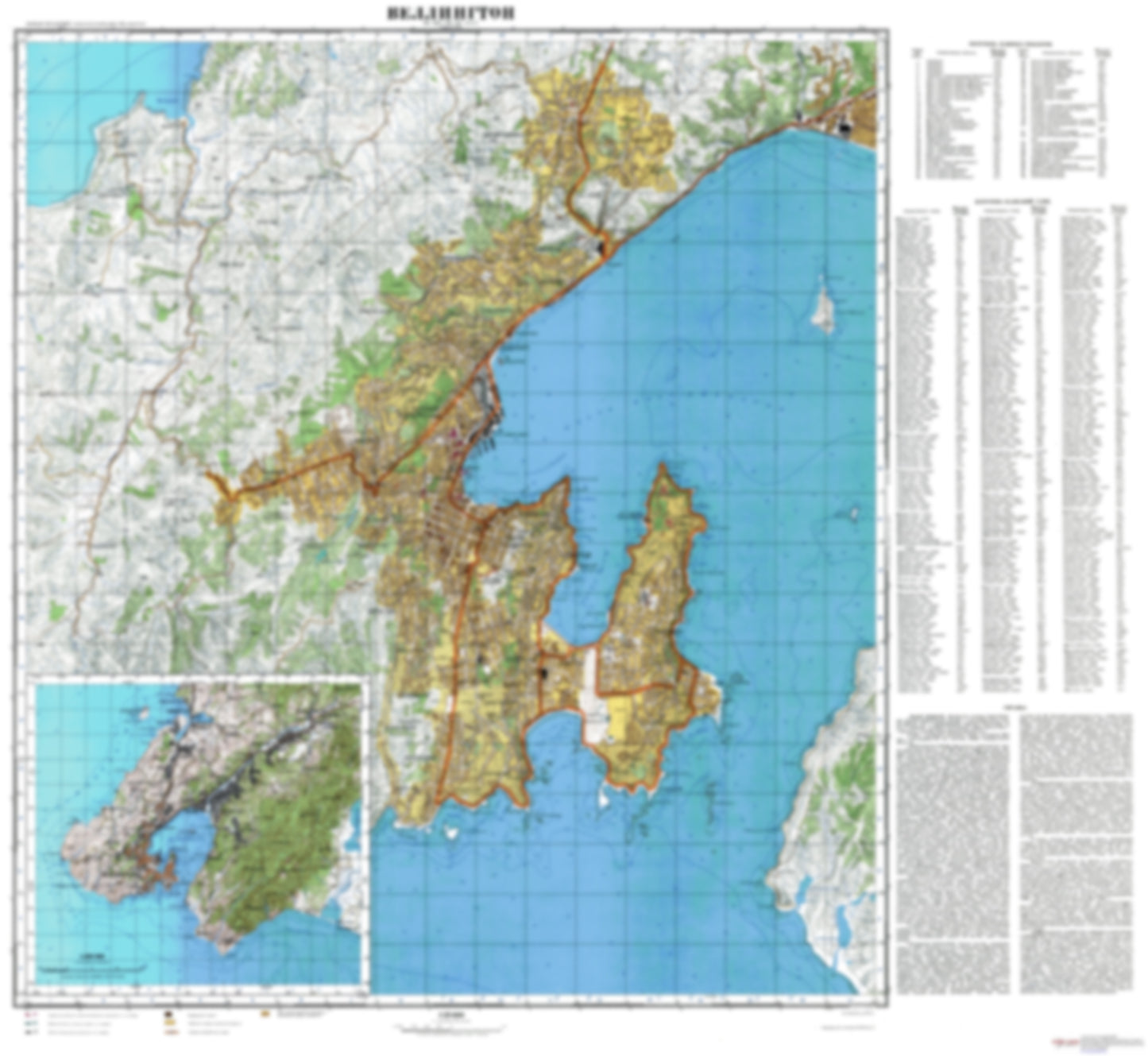
- During the Cold War and before easy access to high-resolution satellite imagery, The Soviet Military was secretly mapping the entire world. These aesthetically striking maps are beautiful down to the last detail and fantastic wall art and until now, have rarely been viewed or available to outsiders. This series has been covered by Wired Magazine and Greg Miller in his book, "All Over the Map: A Cartographic Odyssey". This map is part of the Soviet City Plans Series presented by East View, which has the largest collection of Soviet Military City Plans in the world. The Soviet Military City Plan(s) of Wellington (New Zealand) is one in a series of highly detailed topographic city maps developed by the USSR Ministry of Defense during the Cold War era. These collectable, high resolution print-on-demand editions are delivered on premium, acid-free, matte paper. This item is sheet number 1 in a set of 1 sheet(s) for Wellington Populated Places: Kaiwharawhara, Makara, Makara Beach, Ngauranga, Ohariu, Petone, Te Kainga, Wellington Landmarks and Natural Features: Arthurs Nose, Bluff Point, British Peak, Greta Point, Hawkins Hill, Hinds Point, Hue te Taka Peninsula, Inconstant Point, Kaiwharawhara Point, Kaukau, Makara Hill, Makaro / Ward Island, Matiu / Somes Island, Moa Point, Mokopuna Island, Mount Cameron, Mount Crawford, Mount Victoria, Palmer Head, Point Dorset, Point Gordon, Point Halswell, Point Jerningham, Ranger Point, Sinclair Head, Snapper Point, Taputeranga Island, Te Kopahou, Te Motu Kairangi / Miramar Peninsula Water Bodies: Balaena Bay, Breaker Bay, Camp Bay, Chaffers Passage, Evans Bay, Eve Bay, Flax Bay, Houghton Bay, Island Bay, Karaka Bay, Kau Bay, Kio Bay, Lake Kohangapiripiri, Lake Kohangatera, Little Karaka Bay, Lower Karori Reservoir, Lyall Bay, Mahanga Bay, Ohariu Bay, Opau Bay, Oriental Bay, Owhiro Bay, Palmer Bay, Reef Bay, Scorching Bay, Shark Bay, Shelly Bay, Smiths Bay, Tarakena Bay, Waitaha Cove, Weka Bay, Whairepo Lagoon, Wharehou Bay, Worser Bay
- Subtype: City Plan
- Language: Russian
- Publication Date: 1979-06-01
- Scale: 1:25,000
- Countries Covered: New Zealand
- MPN: WELLINGTON
- Folded Size: N/A
- Unfolded Size: 36.1" (W) x 33.2" (H)
- Weight: 4.8 oz