Raven Maps
Waterton–Glacier International Peace Park Landscape Fine Art Print Map
Waterton–Glacier International Peace Park Landscape Fine Art Print Map
Couldn't load pickup availability
- SKU: PODRP_WG_LS_16X20_WA
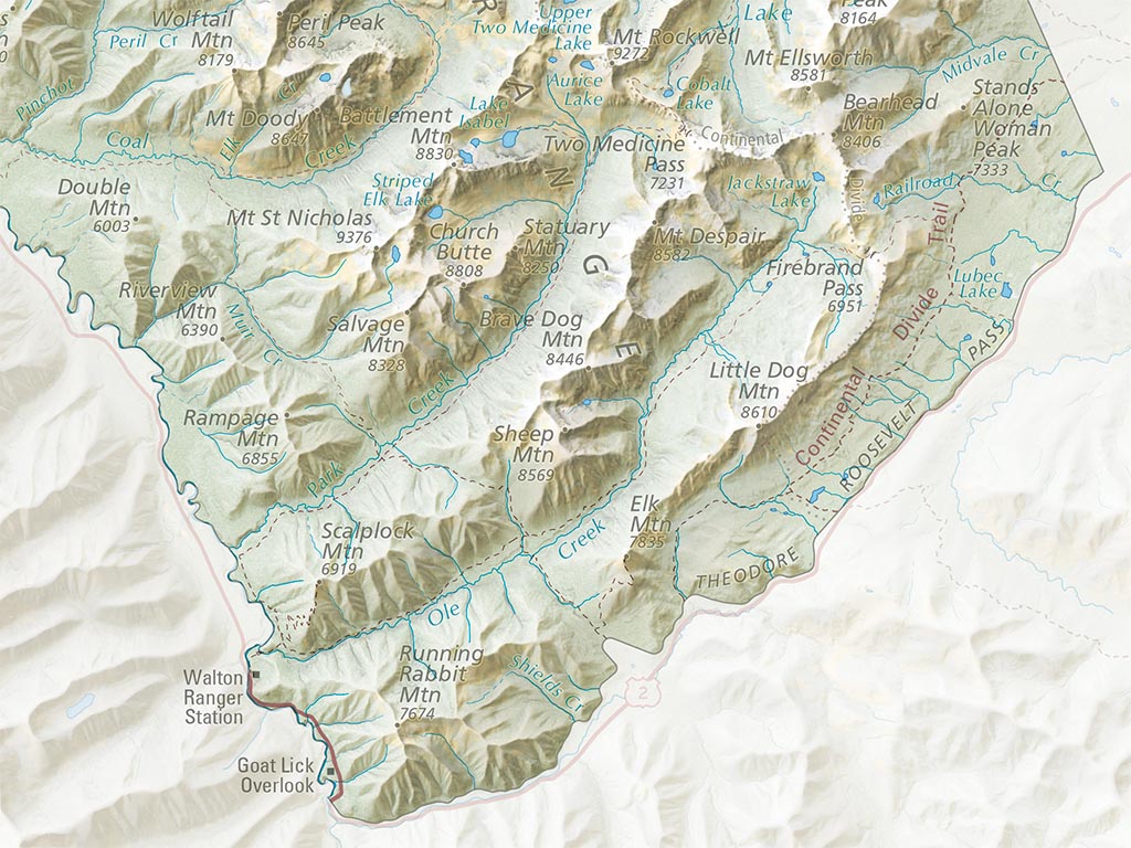
This map illustrates the rugged mountains here at the Crown of the Continent, straddling the border between the United States and Canada. Glacier and Waterton Lakes combine to preserve over 1.1 million acres of stunning, glacially carved landscapes in the Rocky Mountains. A carefully selected color palette illustrates areas of forest, wetland, grassland, and shrubland, all overlaid on beautiful shaded relief that captures the texture and drama of the landscape. Hand-placed labels for mountains, lakes, and rivers fill the park's backcountry while roads, trails, and major points of interest help to orient the viewer and spark memories of adventures in Glacier and Waterton Lakes. Beyond the park boundaries, a softer shaded relief hints at the surrounding landscape. Roads and gateway communities are illustrated with faded hues, providing geographic context for Glacier and Waterton Lakes without distracting from the park itself.
Our Waterton–Glacier International Peace Park landscape map is available in two standard sizes: 24x30"" (1:200,000) and 16x20"" (1:300,000).
- Type: Flat Map
- Subtype: Wall Art
- Language: English
- Scale: 1:300,000
- Regions Covered: North America
- Countries Covered: Canada
- States Covered: Alberta
- UPC: 767020016168
- MPN: PODRP_WG_LS
- Folded Size: N/A
- Unfolded Size: 16" (W) x 20" (H)
- Finish: Regular Paper