Istituto Geografico Centrale S.R.L.
Valli Maira Grana Stura
Valli Maira Grana Stura
Regular price
$15.99 USD
Regular price
Sale price
$15.99 USD
Unit price
per
Shipping calculated at checkout.
Low stock
Couldn't load pickup availability
- SKU: IGC_07_VAL_12
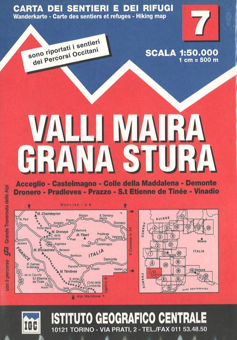
- This is a very detailed topographic hiking map that covers popular trekking locations along the Italian/French/Swiss border, including Balli Maira Grana Stura, Acceglio, Castelmagno, Colle delle Maddalena, Demonte, Dronero, Pradleves, Prazzo, S. Etienne de Tinee, and Vinadio. This map is overlain with extensive hiking information such as trails, overnight huts, tourist cabins, caverns, grottos, and more. The legend is multilingual while the map is in Italian only. 25 meter contour intervals.
- Type: Folded Map
- Subtype: Hiking
- Language: Italian
- Publication Date: 2012-06-01
- Scale: 1:25,000
- Regions Covered: Alps, Europe, Western Europe
- Countries Covered: Italy
- ISBN: 9788896455074
- MPN: 7
- Folded Size: 5" (W) x 8" (H)
- Unfolded Size: 30" (W) x 41" (H)
- Weight: 2.6 oz