Tabacco Map
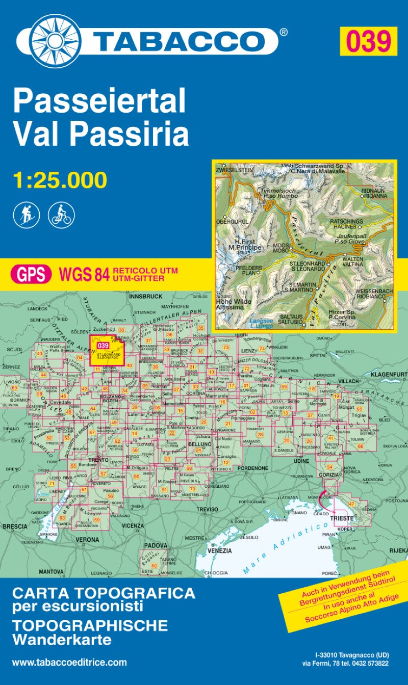
Val Passiria (Paseiertal), Italy Hiking Map (Map #39)
Val Passiria (Paseiertal), Italy Hiking Map (Map #39)
Regular price
$15.99 USD
Regular price
Sale price
$15.99 USD
Unit price
per
Shipping calculated at checkout.
Low stock
Couldn't load pickup availability
- SKU: TAB_39_VALPASSIRIA_19
Explore the stunning Val Passiria region with this detailed topographic map, designed for hikers, cyclists, ski mountaineers, and outdoor enthusiasts. Published in both Italian and German, the map features a UTM WGS84 kilometer grid, along with latitude and longitude tick marks, making it easy to use with GPS devices.
The map includes ski mountaineering routes, cycling tracks, and mountain bike trails, providing reliable navigation for year-round adventures. Trusted by the Mountain Rescue Services of Veneto, South Tyrol, and Friuli Venezia Giulia, this map offers the accuracy and detail needed for both recreational and professional use.
Features:
- Detailed topographic map of Val Passiria
- Bilingual: Italian and German
- UTM WGS84 kilometer grid system
- Latitude and longitude tick marks for GPS navigation
- Ski mountaineering routes included
- Cycling and mountain bike trails marked
- 2019 edition
- Used by the Mountain Rescue Services of Veneto, South Tyrol, and Friuli Venezia Giulia
- Type: Folded Map
- Subtype: Hiking
- Language: German, Italian
- Publication Date: 2019-06-01
- Scale: 1:25,000
- Regions Covered: Alps, Europe, Western Europe
- Countries Covered: Italy
- ISBN: 9788883150395
- MPN: 39
- Folded Size: 5" (W) x 8.5" (H)
- Unfolded Size: 39.5" (W) x 44" (H)
- Weight: 4.6 oz