Tabacco Map
Val di Peio - Val di Rabbi - Val di Sole, Italy Hiking Map
Val di Peio - Val di Rabbi - Val di Sole, Italy Hiking Map
Couldn't load pickup availability
- SKU: TAB_48_VALPEIO_23
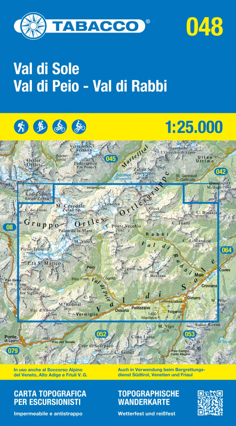
This official Tabacco Editrice topographic map provides detailed coverage of Val di Peio, Val di Rabbi, and Val di Sole, making it an essential navigation tool for hikers, ski mountaineers, cyclists, and mountain bikers.
The map features a UTM WGS84 kilometer grid with latitude and longitude tick marks, ensuring seamless compatibility with GPS devices. It includes clearly marked ski mountaineering routes, cycle tracks, and mountain bike trails for year-round outdoor activities.
Printed on both the front and back covers for maximum detail, this 2023 edition is trusted and used by Mountain Rescue Services in Veneto, South Tyrol, and Friuli Venezia Giulia, highlighting its accuracy and reliability.
The map is bilingual (Italian and German), making it suitable for international users and alpine professionals alike.
Key features:
2023 updated edition
UTM WGS84 kilometer grid system
GPS-friendly with latitude & longitude markings
Ski mountaineering routes, cycling and MTB trails
Front and back full-coverage printing
Used by regional Mountain Rescue Services
Italian & German language
- Type: Folded Map
- Subtype: Hiking
- Language: German, Italian
- Publication Date: 2023-06-01
- Scale: 1:25,000
- Regions Covered: Alps, Europe, Western Europe
- Countries Covered: Italy
- ISBN: 9788883151620
- MPN: 48
- Folded Size: 5" (W) x 8.5" (H)
- Unfolded Size: 39.5" (W) x 44" (H)
- Weight: 4.2 oz