ODT Maps
USA as seen from Canada - 6x9" Map-card - 25-pack
USA as seen from Canada - 6x9" Map-card - 25-pack
Regular price
$24.95 USD
Regular price
Sale price
$24.95 USD
Unit price
per
Shipping calculated at checkout.
Couldn't load pickup availability
- SKU: ODT_CON_US_CA_PC
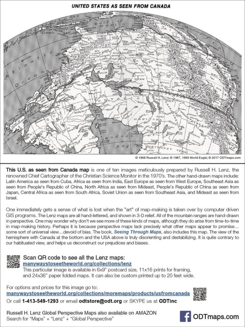
- One of the most unusual maps of the USA we've ever seen. A south-on-top map, it features meticulously hand-drawn rivers and mountain ranges. The divisions between states are represented by dotted lines, so one sees the physical relief features first and foremost. This is a view of North America as if one were seeing it from an orbiting space station somewhere over Canada. Looking at this map, the viewer immediately gets a sense of what is lost when the art of map-making is taken over by computer driven GIS programs. All of the Russell Lenz maps are all hand-lettered, and shown in 3-D relief. All of the mountain ranges are hand-drawn in perspective. One may wonder why don't we see more of these kinds of maps, although they do arise from time-to-time in map-making history.
- Type: Post Card/Greeting Card
- Subtype: Stationery
- Language: English
- Regions Covered: North America
- Countries Covered: Canada, United States
- ISBN: 9781931057790
- Folded Size: N/A
- Unfolded Size: N/A
- Weight: 6.4 oz