Fish-n-Map Company
The Delta (Suisun Bay/Sacramento & San Joaquin Rivers) Fishing Map
The Delta (Suisun Bay/Sacramento & San Joaquin Rivers) Fishing Map
Couldn't load pickup availability
- SKU: FNM_DELTA_19
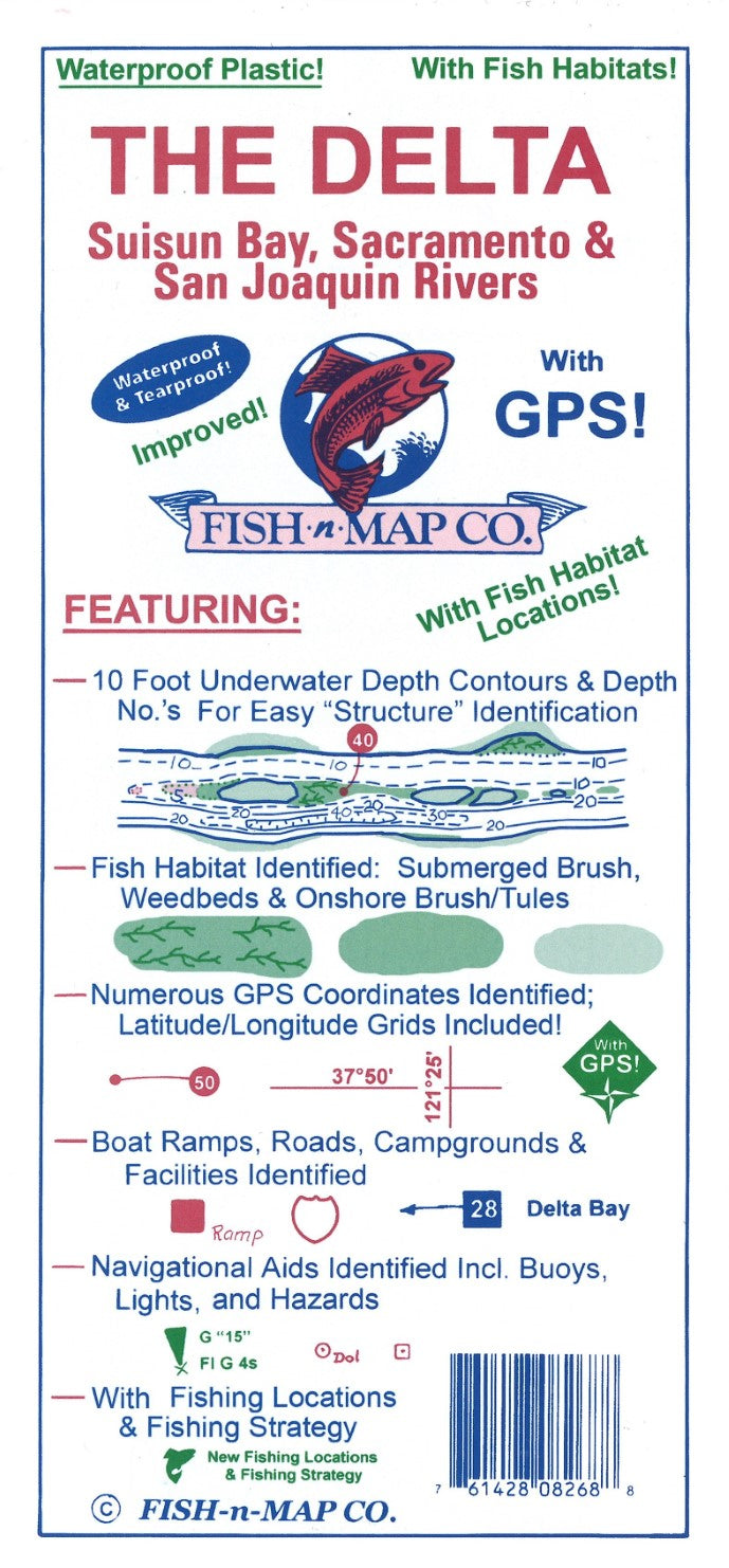
This Fish-N-Map Company underwater topography map is printed on waterproof, tear-resistant material and features 5' underwater depth contours, fish locations, latitude and longitude for GPS, boat ramps, recreational facilities, and much more.
Updated August 2019
• Updated the outline of the water boundaries and weedbeds in the Big Break area
• Added fish habitat including submerged weedbeds throughout the Delta/Suisan Bay areas
• Added submerged brush
• Updated fishing suggestions where necessary
• Added onshore brush and tules
• Updated facilities and roads
• Now a 3-color map
2017 Updates:
Scaled using NAD 83 for Datum
Facilities Updated
FEATURES:
10 Foot Underwater Depth Contours
Fish Holding Tule Plants & Brush Identified
Fishing Suggestions
Fishing Locations with over 100 GPS coordinates provided
Fishing Strategy
Big Break Detail
Navigational Aids Identified incl. Buoys, Lights, Longitude and Latitude
Boat Ramps, Roads, Campgrounds & Facilities Identified
This 2-sided map is printed onto a waterproof and tear-resistant material which folds to 9"x4" and unfolds to 3'x2'
MADE IN THE U.S.A.- Type: Folded Map
- Subtype: Fishing
- Language: English
- Publication Date: 2019-06-01
- Scale: 1:64500
- Regions Covered: North America, Western U.S.
- Countries Covered: United States
- States Covered: California
- UPC: 761428082688
- Folded Size: 3.94" (W) x 9.06" (H)
- Unfolded Size: 35.83" (W) x 23.62" (H)
- Weight: 3.4 oz