National Geographic Maps
Texas Classic Wall Map
Texas Classic Wall Map
Regular price
$29.95 USD
Regular price
Sale price
$29.95 USD
Unit price
per
Shipping calculated at checkout.
Couldn't load pickup availability
- SKU: NG_TX_WA_13
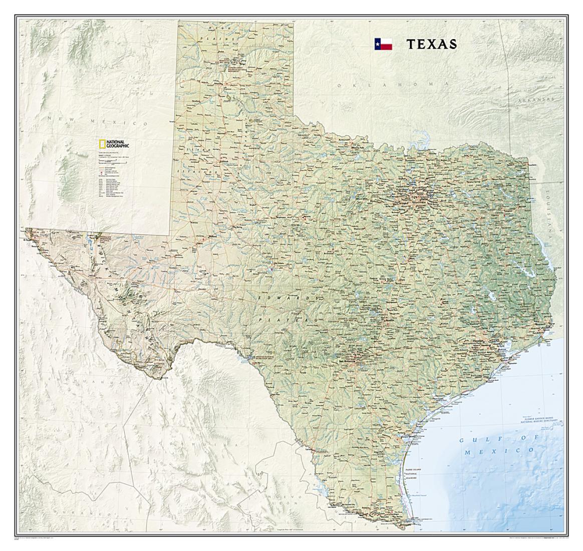
- National Geographic’s wall map of Texas brings the rich and diverse topography of the state to life in elegant detail. Mountain ranges, prominent peaks, major lakes, rivers, and reservoirs, and other geographic features are highlighted. In addition to hundreds of place names, this map includes the precise locations of cities, major roadways and railways, airports, military bases, and national and state parks. Stunning shaded relief and vibrant colorization distinguishes mountain ranges, forests, deserts, valleys, and other physical topography including a portion of the Gulf of Mexico. The Texas portion of the Intracoastal Waterway is shown from Brownsville to the Louisiana border. Part of a growing series of State Wall Maps, this expertly designed map makes an attractive addition to any office or study.
- Type: Wall Map
- Subtype: Political
- Language: English
- Publication Date: 2013-06-01
- Scale: 1:1,314,433
- Regions Covered: North America, Southern U.S.
- Countries Covered: United States
- States Covered: Texas
- ISBN: 9781597752435
- MPN: RE01020409
- Folded Size: N/A
- Unfolded Size: 38.58" (W) x 40.94" (H)
- Weight: 36.33 oz