Latitude 40° Maps
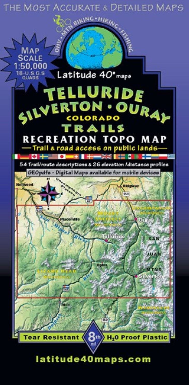
Telluride – Silverton – Ouray Trails Hiking Map
Telluride – Silverton – Ouray Trails Hiking Map
Regular price
$14.95 USD
Regular price
Sale price
$14.95 USD
Unit price
per
Shipping calculated at checkout.
Couldn't load pickup availability
- SKU: LAT40_TELLU_24
- These 3 towns are centered in what is considered the most beautiful mountain range in Colorado-The San Juan Mountains of SW Colorado. Public access trail and road information is shown for all user groups. Two-sided map covers ~25 miles north to south from ~6 miles north of the town of Ouray, south to Molas Pass on US 550. East to west for 42 miles from Handies Peak (14,048’), west to Fish Creek State Wildlife Area. Covers part of the legendary, ”Alpine Loop Scenic Backcountry Byway" from US 550 to west of Lake City. Note: the Alpine Loop is featured in its entirety on SW Colorado Trails. The popular OHV routes between Telluride and US 550, ”Bear Pass", "Imogene Pass" and "Ophir Pass”. Lizard Head and Mount Sneffels Wildernesses in their entirety with parts of Uncompaghre and Weminuche Wilderness. Trailheads, campgrounds, dispersed camping, day use areas, picnic areas, locations of mines, adits, mills, mining camps, active mines and mills, ghost towns, historical townsites and points of interest, waterfalls and hot springs. Telluride and Ouray’s thrilling via ferratta climbing routes, mtn. huts, cabins and inns, special geologic features, scenic viewpoints/overlooks. 26 trail/ route descriptions with elevation/distance profiles, mileage and difficulty ratings. Plus a listing of 28 additional trail/route options. Note: almost all routes, except in the valley floors, are sustained climbs for muscle powered sports enthusiasts, often up very steep terrain with challenging descents on the return. The west side of the map shows the landscape to the west of Telluride, including the San Miguel Mountains in Lizard Head Wilderness with three 14ers - El Diente, Mt. Wilson and Wilson Peak. Reference our regional map, Southwest Colorado Trails to connect and follow all routes that extend beyond this maps boundaries. Telluride-SilvertonOuray Trails overlaps Durango Trails at the same scale.
- Type: Folded Map
- Subtype: Hiking
- Language: English
- Publication Date: 2024-06-01
- Scale: 1:50,000
- Regions Covered: Central U.S., North America
- Countries Covered: United States
- States Covered: Colorado
- ISBN: 9781879866584
- Folded Size: 4" (W) x 8" (H)
- Unfolded Size: 25" (W) x 39" (H)
- Weight: 3 oz