USSR Ministry of Defense
Tel Aviv 4 (Israel) - Soviet Military City Plans
Tel Aviv 4 (Israel) - Soviet Military City Plans
Regular price
$49.95 USD
Regular price
Sale price
$49.95 USD
Unit price
per
Shipping calculated at checkout.
Couldn't load pickup availability
- SKU: SUAA-TELAVIV4-P
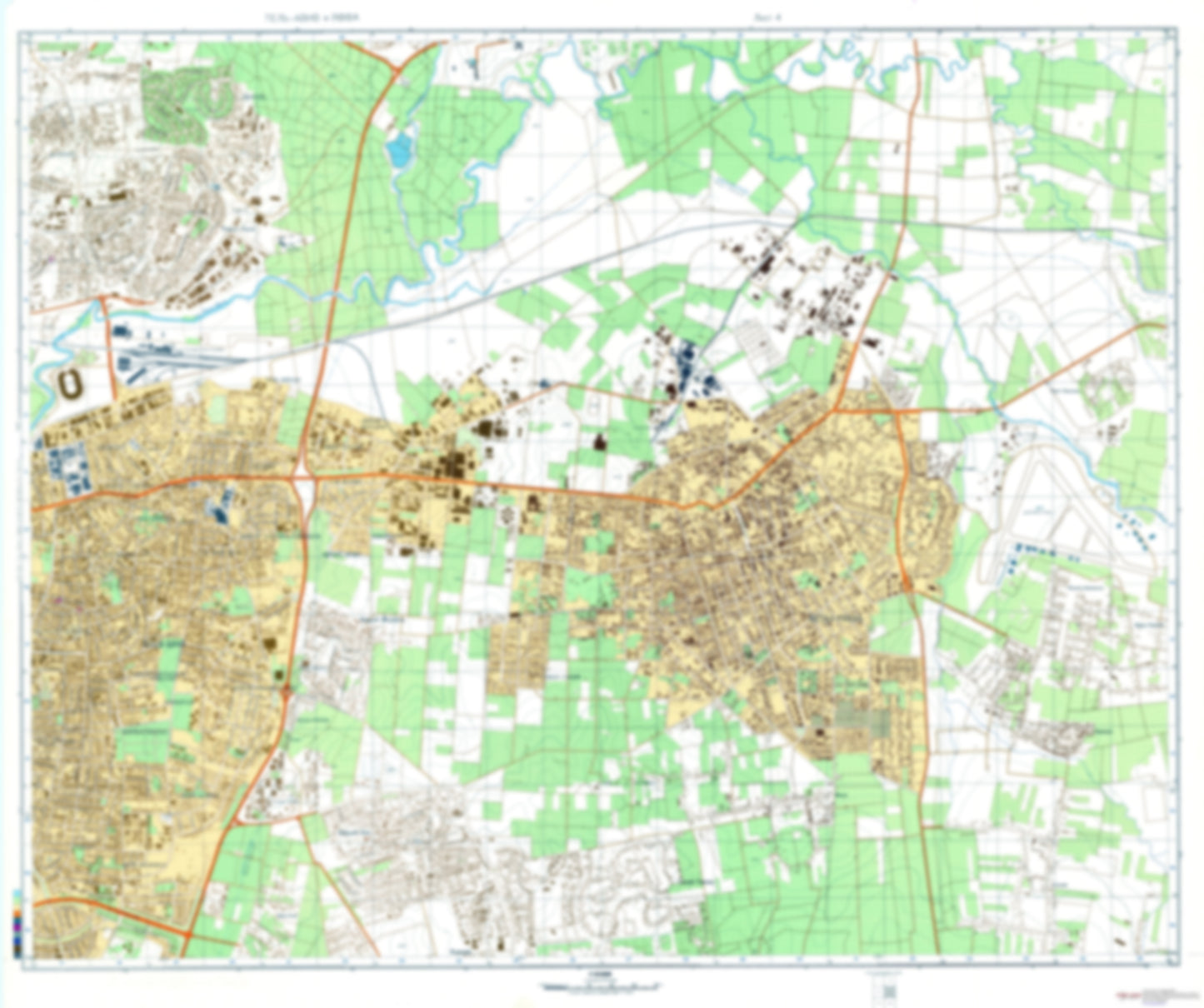
- During the Cold War and before easy access to high-resolution satellite imagery, The Soviet Military was secretly mapping the entire world. These aesthetically striking maps are beautiful down to the last detail and fantastic wall art and until now, have rarely been viewed or available to outsiders. This series has been covered by Wired Magazine and Greg Miller in his book, "All Over the Map: A Cartographic Odyssey". This map is part of the Soviet City Plans Series presented by East View, which has the largest collection of Soviet Military City Plans in the world. The Soviet Military City Plan(s) of Tel Aviv 4 (Israel) is one in a series of highly detailed topographic city maps developed by the USSR Ministry of Defense during the Cold War era. These collectable, high resolution print-on-demand editions are delivered on premium, acid-free, matte paper. This item is sheet number 4 in a set of 6 sheet(s) for Tel Aviv Populated Places: Bne Braq, Ganne Tiqva, Gat Rimmon, Giv'At Hashlosha, Giv'At Shmu'el, Hamerkaz, Kefar Sirkin, Ma'As, Mehoz Hamerkaz, Nafat Petah Tiqvva, Nehalim, Petah Tiqva, Petah Tiqvva, Qiryat Ono Parks and Reservations: Gan Herut, Gan Le'ummi Maqorot HaYarqon, Gan Newe Yehoshu'A, Gan Sa'Adya Shoshani, Gan Sheshet HaYamim, Gan Yakir, Parq Dawid Landmarks and Natural Features: Universitat Bar Ilan
- Subtype: City Plan
- Language: Russian
- Publication Date: 1985-06-01
- Scale: 1:10,000
- Countries Covered: Israel
- MPN: TEL AVIV4
- Folded Size: N/A
- Unfolded Size: 41.6" (W) x 34.9" (H)
- Weight: 4.8 oz