Tom Patterson Maps
Tahiti and Moorea - Premium Photo Paper
Tahiti and Moorea - Premium Photo Paper
Regular price
$60.00 USD
Regular price
Sale price
$60.00 USD
Unit price
per
Shipping calculated at checkout.
Couldn't load pickup availability
- SKU: PODTP_TAHITI_EPS
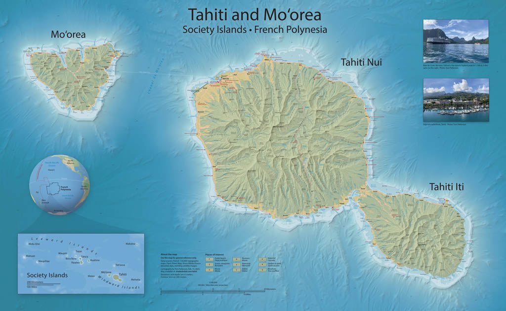
- Mapping Tahiti and Mo‘orea is something that I have wanted to do since visiting these islands in 2019. But incomplete elevation data delayed my plans until recently with the release of 20-meter elevation data of Tahiti and Mo‘orea, and 100-meter bathymetric data of the surrounding seafloor. The reference map created from these new data highlight three unique environments: the ocean bottom from which the volcanoes that became Tahiti and Mo‘orea arose; the narrow coastal strips alive with coral reefs and burgeoning human settlement; and, moving inland, cloud-capped mountain spires. The map includes popular tourist sites. Topography is represented with shaded relief and contour lines. Elevations are in meters. Premium Luster Photo Paper (Gallery-Quality Print) Printed on Epson Premium Luster Photo Paper, this is our highest-end paper option. It delivers exceptionally rich color, deep blacks, and crisp detail with a subtle satin-luster finish that reduces glare while maintaining photographic depth. This premium stock is designed for presentation-quality prints and professional display. Best for: Collector pieces, presentation maps, exhibitions, and premium framing.
- Subtype: Wall Art
- Language: English
- Scale: 1:100000
- Folded Size: N/A
- Unfolded Size: 38" (W) x 24.2" (H)