USSR Ministry of Defense
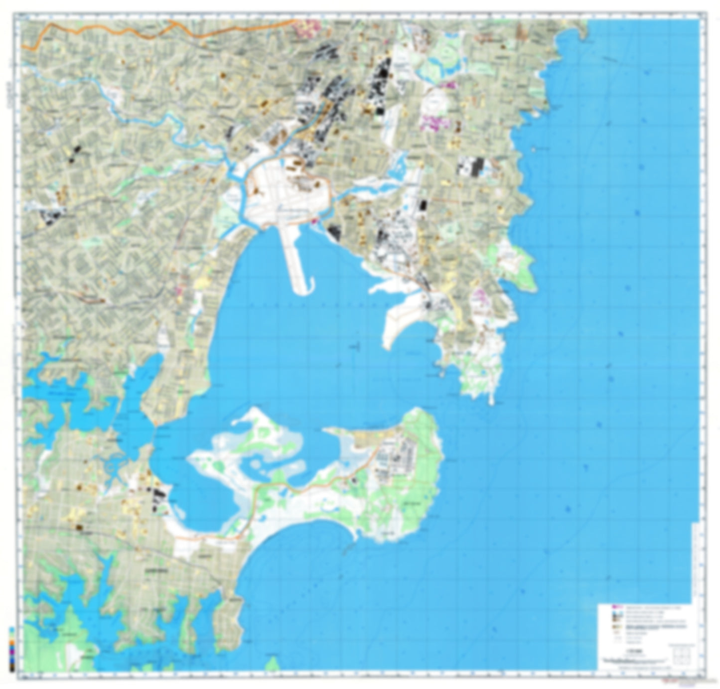
Sydney 4 (Australia) - Soviet Military City Plans
Sydney 4 (Australia) - Soviet Military City Plans
Regular price
$49.95 USD
Regular price
Sale price
$49.95 USD
Unit price
per
Shipping calculated at checkout.
Couldn't load pickup availability
- SKU: SUAA-SYDNEY_4-P
- During the Cold War and before easy access to high-resolution satellite imagery, The Soviet Military was secretly mapping the entire world. These aesthetically striking maps are beautiful down to the last detail and fantastic wall art and until now, have rarely been viewed or available to outsiders. This series has been covered by Wired Magazine and Greg Miller in his book, "All Over the Map: A Cartographic Odyssey". This map is part of the Soviet City Plans Series presented by East View, which has the largest collection of Soviet Military City Plans in the world. The Soviet Military City Plan(s) of Sydney 4 (Australia) is one in a series of highly detailed topographic city maps developed by the USSR Ministry of Defense during the Cold War era. These collectable, high resolution print-on-demand editions are delivered on premium, acid-free, matte paper. This item is sheet number 4 in a set of 4 sheet(s) for Sydney Populated Places: Alexandria, Bexley, Bondi, Botany, Bronte, Camperdown, Caringbah, Clovelly, Coogee, Cronulla, Daceyville, Deer Park, Earlwood, Gundamaian, Kensington, Kogarah, Kurnell, La Perouse, Lakemba, Malabar, Maroubra, Marrickville, Mascot, Matraville, Miranda, Mortdale, Newtown, Penshurst, Port Hacking, Randwick, Randwick, Redfern, Rockdale, Rosebery, Saint Peters, South Sydney Municipality, Tempe, Waterloo, Waverley Landmarks and Natural Features: Alexander Mackie College of Advance Education, Bald Face Point, Bare Island, Bear Islet, Belmore Sportsground, Ben Buckler, Blackwoods Beach, Bondi Beach, Bonna Point, Boora Point, Bronte Beach, Burraneer Point, Cabbage Tree Point, Cape Baily, Cape Baily, Cape Banks, Cape Solander, Caravan Head, Carters Island, Clovelly Beach, College of Advanced Education, Connells Point, Constables Point, Coogee Beach, Costens Point Water Bodies: Bate Bay, Botany Bay, Burraneer Bay, Clovelly Bay, Connells Bay, Coogee Bay, Ewey Bay, Gannons Bay, Gordons Bay, Kyle Bay, Leg of Mutton Bay, Little Coogee Bay, Malabar Bay, Nelsons Bay, Salmon Haul, Sandringham Bay, Shipwrights Bay, Stingray Harbour, Tamarama Bay, Thompsons Bay, Townsons Bay, Towra Bay, Weeney Bay, Woolooware Bay, Yowie Bay
- Subtype: City Plan
- Language: Russian
- Publication Date: 1984-06-01
- Scale: 1:25,000
- Countries Covered: Australia
- MPN: SYDNEY_4
- Folded Size: N/A
- Unfolded Size: 37.5" (W) x 35.9" (H)
- Weight: 4.8 oz