Tom Patterson Maps
Svalbard: Norway's High-Arctic Archipelago - Paper
Svalbard: Norway's High-Arctic Archipelago - Paper
Regular price
$25.00 USD
Regular price
Sale price
$25.00 USD
Unit price
per
Shipping calculated at checkout.
Couldn't load pickup availability
- SKU: PODTP_SVALBARD
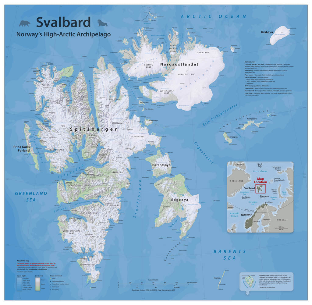
- These islands on Europe's northern fringe are famous for northern lights, polar bears, and walruses. Much of this map is based on publicly-available data from the Norwegian Polar Institute. However, the glaciers that cover 60 percent of the land surface are melting rapidly. This necessitated remapping their extents from recent satellite images. The map includes generalized land cover combined with shaded relief, and depth tints are shown in the ocean. Points of interest to visitors are also included. Elevations are in meters. Standard Matte Paper (Archival Map Print) Printed on our standard high-quality matte paper, this option offers excellent color accuracy and fine detail with a smooth, non-reflective finish. The matte surface minimizes glare, making it ideal for reading, studying, and framing under glass. FSC-certified and well-suited for both wall display and frequent reference. Best for: Everyday wall maps, educational use, libraries, offices, and framing.
- Subtype: Wall Art
- Language: English
- Scale: 1:750000
- Folded Size: N/A
- Unfolded Size: 36" (W) x 35.2" (H)