Tom Patterson Maps
Svalbard: Norway's High-Arctic Archipelago - Laminated
Svalbard: Norway's High-Arctic Archipelago - Laminated
Regular price
$30.00 USD
Regular price
Sale price
$30.00 USD
Unit price
per
Shipping calculated at checkout.
Couldn't load pickup availability
- SKU: PODTP_SVALBARD_LAM
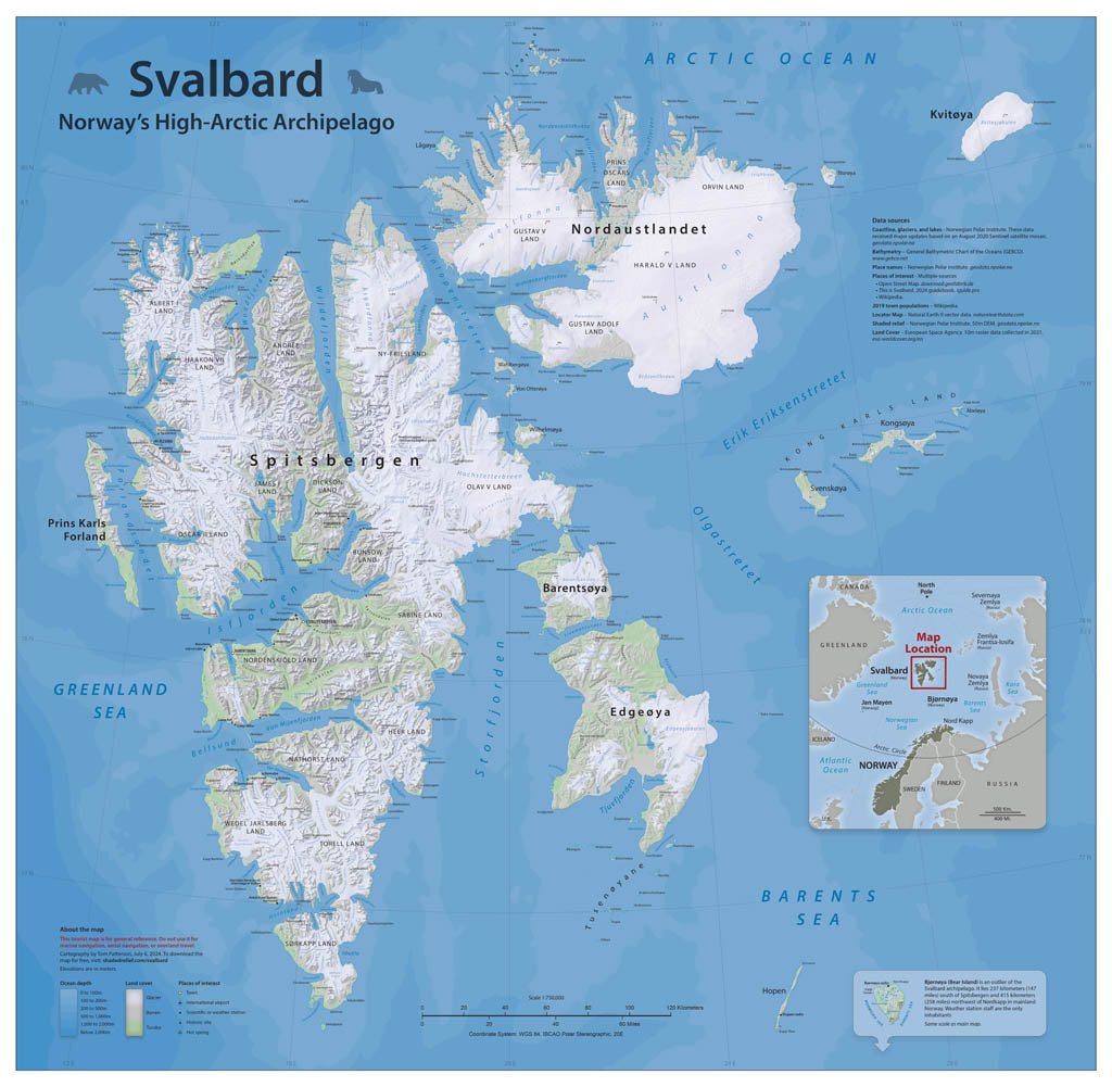
- These islands on Europe's northern fringe are famous for northern lights, polar bears, and walruses. Much of this map is based on publicly-available data from the Norwegian Polar Institute. However, the glaciers that cover 60 percent of the land surface are melting rapidly. This necessitated remapping their extents from recent satellite images. The map includes generalized land cover combined with shaded relief, and depth tints are shown in the ocean. Points of interest to visitors are also included. Elevations are in meters. Gloss Laminated Paper (Durable, High-Impact Finish) This option begins with our standard matte paper and is finished with a professional gloss laminate. The lamination enhances color vibrancy and contrast while adding durability and moisture resistance. The glossy surface is easy to wipe clean and helps protect the map from handling, making it ideal for long-term use. Best for: Classrooms, public spaces, field use, planning environments, and high-traffic areas.
- Subtype: Wall Art
- Language: English
- Scale: 1:750000
- Folded Size: N/A
- Unfolded Size: 36" (W) x 35.2" (H)