Latitude 40° Maps
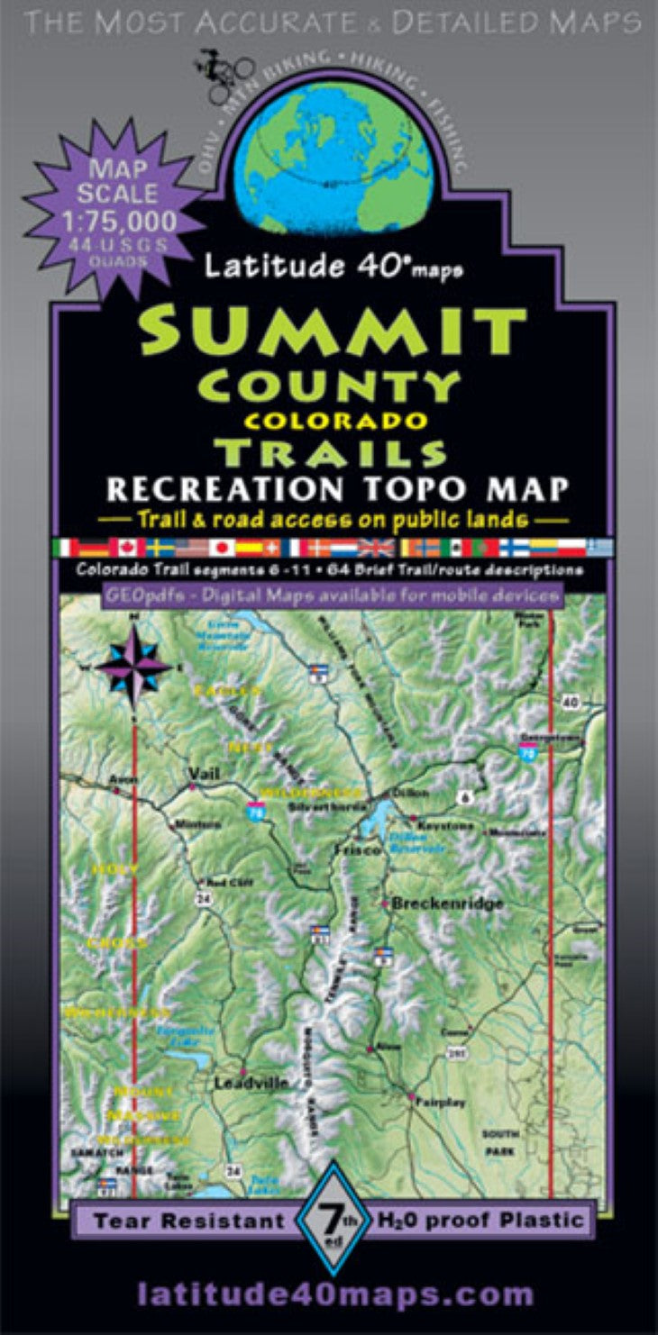
Summit County Trails Hiking Map
Summit County Trails Hiking Map
Regular price
$14.95 USD
Regular price
Sale price
$14.95 USD
Unit price
per
Shipping calculated at checkout.
Low stock
Couldn't load pickup availability
- SKU: LAT40_SUMMIT_22
- The preferred map of choice used by Summit County Search and Rescue. Public access trail and road information is shown for all user groups. Two-sided map covers 58 miles north to south from Green Mtn. Reservoir, south to Twin Lakes. East to west for 40 miles from Kenosha Pass on Hwy. 285, west to Mt. Massive (west of Leadville). All or parts of seven wilderness areas: Eagles Nest, Holy Cross, Ptarmigan, Vasquez Peak, Byers Peak, Buffalo Peaks and Mt. Massive. 11 peaks over 14,000’-14ers: Grays and Torreys, Democrat, Cameron, Lincoln, Bross, Quandary, Sherman, Mt. of the Holy Cross, Massive and Mt. Elbert (Colorado’s highest peak 14433’). Trailheads, campgrounds, dispersed camping, picnic areas, day use areas, parking/ pullouts, mtn. huts, cabins and yurts, hot springs, locations of mines, adits, mills, mining camps, active mines and mills, ghost towns, historical sites, special geologic features, scenic viewpoints/overlooks, points of interest, bristlecone pine scenic areas and gold medal fishing waters. Enlarged inset map (1"= 0.6 mi) of Breckenridge and the Golden Horseshoe, shows all trails and roads leaving town in all directions. All paved recreation pathways/bike paths are highlighted throughout the map area. Includes Colorado Trail segments 6-11 (Kenosha Pass to Twin Lakes). Mileage between junctions and route difficulty ratings. A listing of 64 brief trail/ route descriptions on the south side of map. Summit County Trails and Salida-Buena Vista Trails (at the same scale) used together, overlap for ~115 miles of contiguous, north-south map coverage. Map coverage goes far beyond the Summit County boundary and includes the towns of Dillon, Frisco, Fairplay, Keystone, Leadville, Silverthorne, Vail, and Winter Park. Reference our regional map, Crested Butte-Aspen-Gunnison Trails to connect and follow some of the routes that extend beyond this maps southwestern boundary.
- Type: Folded Map
- Subtype: Hiking
- Language: English
- Publication Date: 2022-06-01
- Scale: 1:75,000
- Regions Covered: Central U.S., North America
- Countries Covered: United States
- States Covered: Colorado
- ISBN: 9781879866492
- Folded Size: 4" (W) x 8" (H)
- Unfolded Size: 25" (W) x 39" (H)
- Weight: 3 oz