Latitude 40° Maps
Steamboat – Routt National Forest Trails Hiking Map
Steamboat – Routt National Forest Trails Hiking Map
Regular price
$14.95 USD
Regular price
Sale price
$14.95 USD
Unit price
per
Shipping calculated at checkout.
Low stock
Couldn't load pickup availability
- SKU: LAT40_STEAM_20
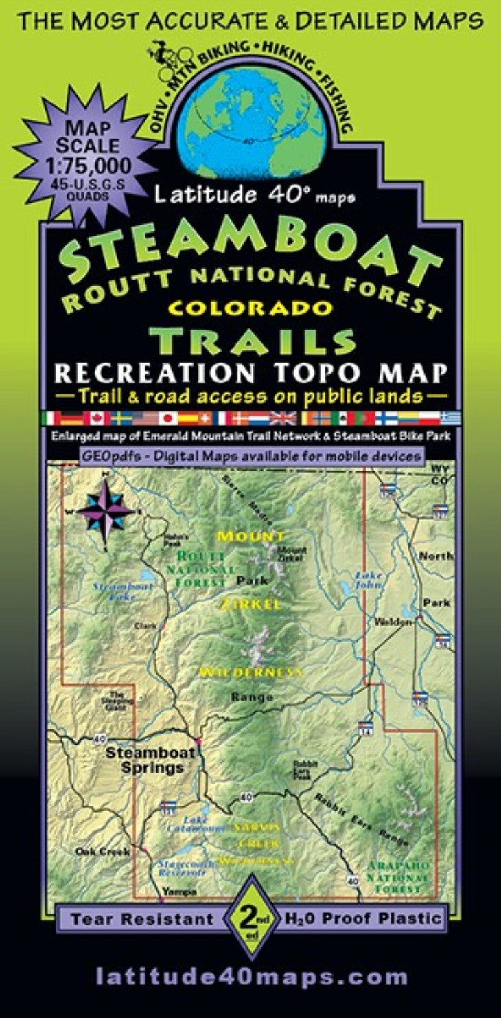
- Incomparable adventure zone in the Northern Colorado Rocky Mountains, with wide ranging opportunities to experience this area: hiking, mtn. biking, hunting, fishing, kayaking, rafting, SUPing, OHV and unparralled snowsports options. Steamboat Springs and the surrounding area has an “old west Colorado” vibe. Great historic charm, tons of trails and roads leading to hot springs, thunderous waterfalls and meadows filled with wildflowers. Two-sided map covers 58 miles north to south from the Colorado/Wyoming border, south to the town of Yampa. East to west for 40 miles from Delaney Buttes State Wildlife Area (on the western edge of North Park), west to the town of Oak Creek. The back-side includes an enlarged inset (1"= 0.6 miles) map of Steamboat Springs with Emerald Mtn. Tr. Network, Steamboat Bike Park and all routes leaving town in all directions. Covers the "Continental Divide National Scenic Trail Route (CDT)” roughly 120 miles from the CO/WY border to Poison Ridge/Sheep Mountain in the eastern Rabbit Ears Range. Includes winter snow routes for XC skiing and snowmobiling on Rabbit Ears Pass and the Hogan Park winter XC route to Steamboat. Stagecoach Reservoir, Steamboat Lake (Gold medal waters) and Pearl Lake State Parks. Dozens of State Wildlife Areas and State Trust Lands, Forest Service and BLM lands. Mount Zirkel Wilderness, Sarvis Wilderness and Troublesome WSA. Trailheads, campgrounds, dispersed camping, picnic areas, day use areas, parking/pullouts, mtn. huts, cabins and yurts, hot springs, historical sites, special geologic features, scenic viewpoints/overlooks. Public access trail and road information is shown for all user groups. Includes a listing of 63 brief trail/route options with difficulty ratings, distance, elevation gain and loss. East side of map overlaps Rocky Mountain NPWinter Park Trails at the same scale.
- Type: Folded Map
- Subtype: Hiking
- Language: English
- Publication Date: 2020-06-01
- Scale: 1:75,000
- Regions Covered: Central U.S., North America
- Countries Covered: United States
- States Covered: Colorado
- ISBN: 9781879866423
- Folded Size: 4" (W) x 8" (H)
- Unfolded Size: 25" (W) x 39" (H)
- Weight: 3 oz