NOAA
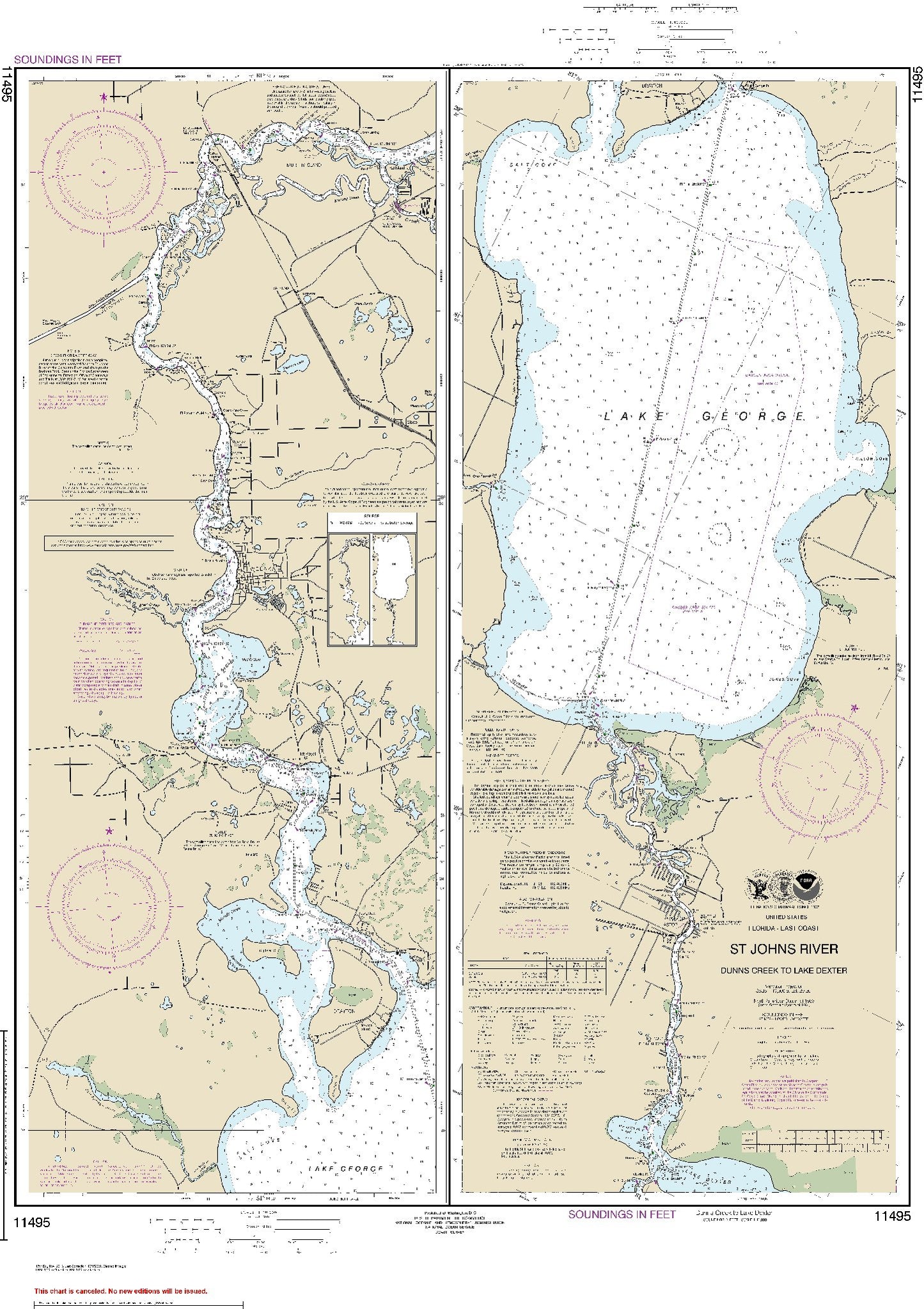
St. Johns River - Side A: Dunns Creek to Lake Dexter - Left Panel (11495) by NOAA
St. Johns River - Side A: Dunns Creek to Lake Dexter - Left Panel (11495) by NOAA
Regular price
$19.00 USD
Regular price
Sale price
$19.00 USD
Unit price
per
Shipping calculated at checkout.
Couldn't load pickup availability
- SKU: USAC-11495-P
- Notice:NOAA-OCS cancelled Raster and PDF chart 11495- St. Johns River Dunns Creek to Lake Dexter, Edition #17 on April 6, 2022. The product will NOT meet U. S. and international carriage requirements for commercial vessels defined in SOLAS Chapter V Regulation 19.2.1.
- Type: Flat Map
- Subtype: General Nautical
- Language: English
- Publication Date: 2013-11-01
- Scale: 1:40,000
- Countries Covered: United States
- MPN: 11495
- Folded Size: N/A
- Unfolded Size: 27.77" (W) x 37.9" (H)