Latitude 40° Maps
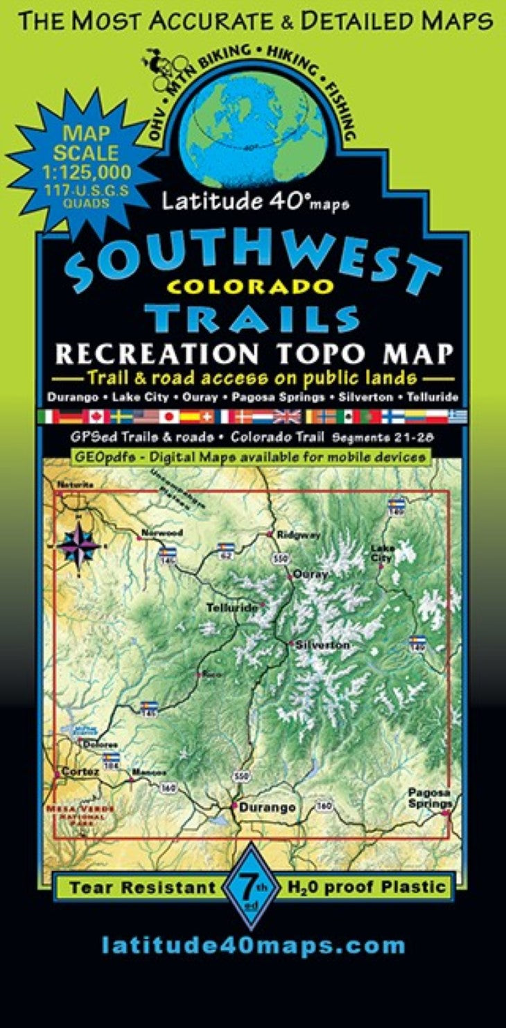
Southwest Colorado Trails Hiking Map
Southwest Colorado Trails Hiking Map
Regular price
$14.95 USD
Regular price
Sale price
$14.95 USD
Unit price
per
Shipping calculated at checkout.
Couldn't load pickup availability
- SKU: LAT40_SW_CO_25
- By far the most action packed recreation map of Southwest Colorado ever published due to the vastness of this incredibly scenic region. It took a very, very long time researching the area as the map was built and continues to require so much research going through inch by inch with each update and reprint. We get a ton of great feedback and people seem to love it. So….here it is in all its enormousness, immensity and expansive hugeness. Public access trail and road information is shown for all user groups. Two-sided map covers a distance of 74 miles north to south from Ridgway State Park, south to Mesa Verde National Park (NP). East to west for 88 miles from the town of Pagosa Springs, west to Cortez. Trailheads, campgrounds, dispersed camping, day use areas, picnic areas, locations of mines, adits, mills, mining camps, ghost towns, historical townsites and points of interest, waterfalls and hot springs. Telluride and Ouray’s thrilling via ferratta climbing routes, mtn. lodges, huts, cabins and inns, special geologic features and scenic viewpoints/overlooks. 13 Peaks/Mtns. over 14,000’-14ers: El Diente, Eolus, N. Eolus, Handies, Red Cloud, Sneffles, Sunlight, Sunshine, Uncompahgre, Wetterhorn, Windom, Wilson Pk. and Mt. Wilson. Popular routes for backcountry enthusiasts on the Colorado Trail (segments 21-28), the Continental Divide Trail (CDT), the legendary and world renowned Alpine Loop Scenic Backcountry Byway. and Hundreds of miles of OHV and motorized singletrack routes. Weminuche, Lizard Head, Mt. Sneffels, Uncompahgre, Powderhorn and Hermosa Creek Wilderness areas and Mesa Verde NP. This is the only small scale map of the area, with surprising detail and accuracy. Reference this map to connect and follow all routes that extend beyond Telluride-Silverton-Ouray Trails and Durango Trails boundaries.
- Type: Folded Map
- Subtype: Hiking
- Language: English
- Publication Date: 2025-06-01
- Scale: 1:125,000
- Regions Covered: Central U.S., North America
- Countries Covered: United States
- States Covered: Colorado
- ISBN: 9781879866607
- Folded Size: 4" (W) x 8" (H)
- Unfolded Size: 25" (W) x 39" (H)
- Weight: 3 oz