Fish-n-Map Company
Snake River, Idaho Fishing Map
Snake River, Idaho Fishing Map
Couldn't load pickup availability
- SKU: FNM_SN_RIV_22
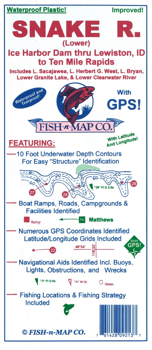
Fish-N-Map Company underwater topography maps are printed on a waterproof, tear-resistant material and are folded to 9" x 4". When opened, each map is approximately 3' x 2' in size and is printed on both sides. These maps feature waterproof plastic "paper"; underwater depth contours; fish locations; latitude and longitude for GPS; often multiple lakes on one map; boat ramps; recreational facilities; and much more.
Snake River (Lower), Ice Harbor Dam through Lewiston, Idaho to Ten Mile Rapids. Includes Lake Sacajawea, Lake Herbert G. West, Lake Bryan, Lower Granite Lake and Lower Clearwater River
Printed onto a waterproof, tear-resistant material which folds to 9" x 4" and unfolds to 3' x 2'.
FEATURES:
10-foot Underwater Depth Contours
Numerous Fishing Suggestions plus a Fishing Strategy Included
Over 100 GPS Coordinates Identified
Latitude and Longitude Grids Included
Navigational Aids Identified including buoys, lights, obstructions and wrecks
Boat Ramps, Campgrounds and Facilities Shown
MADE IN THE U.S.A.- Type: Folded Map
- Subtype: Fishing
- Language: English
- Publication Date: 2022-06-01
- Scale: Scale not provided
- Regions Covered: North America, North-central U.S./Great Plains
- Countries Covered: United States
- States Covered: Idaho
- UPC: 761428092137
- Folded Size: 4" (W) x 9" (H)
- Unfolded Size: 36" (W) x 24" (H)
- Weight: 1.8 oz