Raven Maps
Sierra Nevada Elevation Tints Fine Art Print Map
Sierra Nevada Elevation Tints Fine Art Print Map
Couldn't load pickup availability
- SKU: PODRP_SIERRA_NV_ELEV_24X36_WA
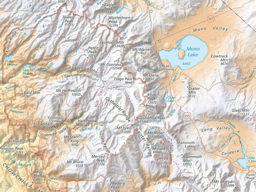
his magnificent range of gleaming peaks is home to some of the country's most iconic natural wonders: groves of giant sequoias; the lofty summit of Mt Whitney, highest peak in the Lower 48; the sheer granite faces of El Capitan and Half Dome above Yosemite Valley. This map of the Sierra Nevada pairs beautiful shaded relief with hypsometric tinting, highlighting the range's complex topography from its loftiest peaks to the lowest foothills. Beyond the range, the colors fade away leaving a subtler grayscale shading to provide a simplified context for the Sierra Nevada, keeping the map focused on the mountains that John Muir called "the Range of Light."
We have three new versions of this fine art map of the Sierra Nevada: Large (54" X 36"), Medium (original size 45" X 30"), and Small (36" X 24")
Dimensions: All map dimensions are approximate.
- Type: Flat Map
- Subtype: Wall Art
- Language: English
- Regions Covered: North America, Western U.S.
- Countries Covered: United States
- States Covered: California, Nevada
- UPC: 767020015130
- MPN: PODRP_SIERRA_NV_ELEV_LG
- Folded Size: N/A
- Unfolded Size: 24" (W) x 36" (H)
- Finish: Regular Paper