Fish-n-Map Company
San Juan Islands, Victoria, B.C., Strait of Juan de Fuca Fishing Map
San Juan Islands, Victoria, B.C., Strait of Juan de Fuca Fishing Map
Couldn't load pickup availability
- SKU: FNM_SAN_JUAN_21
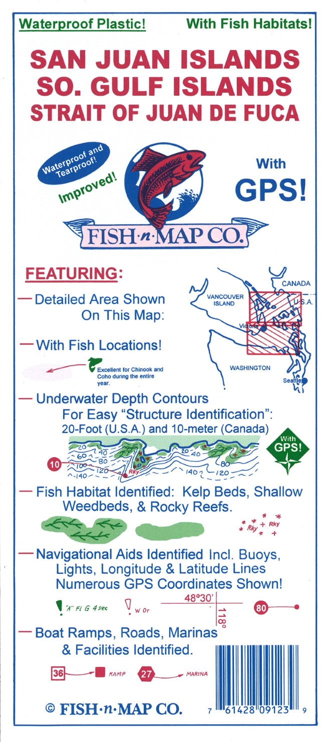
Fish-N-Map Company underwater topography maps are printed on a waterproof, tear-resistant material and are folded to 9" x 4". When opened, each map is approximately 3' x 2' in size and is printed on both sides. These maps feature waterproof plastic "paper"; underwater depth contours; fish locations; latitude and longitude for GPS; often multiple lakes on one map; boat ramps; recreational facilities; and much more.
2021 UPDATES:
Added onshore trees in green
Added shallow submerged weedbeds and additional kelp beds
Updated facilities and boat ramps
FEATURES:
• 20-foot (U.S.A.) and 10-meter (Canada) Underwater Depth Contours
• Underwater Features identified including underwater bottom conditions, kelp beds, shallow shoals, submerged rocks (Navigational hazards) and wrecks
• Latitude and Longitude Grids with numerous GPS Coordinates Identified
• Numerous Fish Locations presented throughout chart
• Boat ramps and Facilities information provided
• Waterproof and Tear-resistant plastic, folds to 9" x 4", unfolds to 3' x 2', 2-sided chart
MADE IN THE U.S.A.- Type: Folded Map
- Subtype: Fishing
- Language: English
- Publication Date: 2021-06-01
- Scale: Scale not provided
- Regions Covered: North America, Northwestern U.S.
- Countries Covered: United States
- States Covered: Washington
- UPC: 761428091239
- Folded Size: 4" (W) x 9" (H)
- Unfolded Size: 36" (W) x 24" (H)
- Weight: 2.9 oz