Latitude 40° Maps
Salida – Buena Vista Trails Hiking Map
Salida – Buena Vista Trails Hiking Map
Regular price
$14.95 USD
Regular price
Sale price
$14.95 USD
Unit price
per
Shipping calculated at checkout.
Couldn't load pickup availability
- SKU: LAT40_SAILDA_24
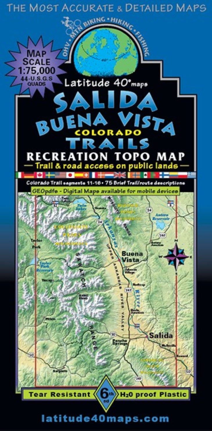
- An awesome area highlighting the Upper Arkansas River Valley in the heart of the central Colorado Rocky Mountains, a recreation wonderland. Public access trail and road information is shown for all user groups. Two-sided map covers 58 miles north to south from Mt. Elbert (Colorados highest peak-14,433’), south to the ghost town of Bonanza. East to west for 40 miles from the small town of Howard (on the Arkansas River), west to the east side of Taylor Park Reservoir. Crested Butte/Taylor Park Trails map overlaps this map. 13 peaks over 14,000 with mountaineering routes and mileage -14ers: Antero, Belford, Columbia, Elbert, Harvard, Huron, La Plata, Missouri, Oxford, Princeton, Shavano, Tabeguache and Yale. Includes a short listing and basic information on the 14ers. Colorado Trail segments (11-16) from Twin Lakes along the flanks of the Collegiate Peaks through the Cochetopa Hills south of Sargents and the entire "Collegiate West addition to the Colorado Trail.” 38 miles of the epic and legendary "Monarch Crest Trail route"(recognized as one of the top ten trails/rides in North America) plus the northern section of the Rainbow Trail. Collegiate Peaks and Buffalo Peaks Wilderness Areas. Trailheads, campgrounds, dispersed camping, hot springs, mtn. huts, cabins and yurts, mines, adits, mills, mining camps, ghost towns, historical townsites, geologic points of interest, and scenic viewpoints/overlooks. Browns Canyon National Monument, State Wildlife Areas (SWA) and State Trust Lands (STL), Fourmile Travel Management Area (east of Buena Vista) with trails, motorized singletrack and OHV routes. Arkansas Hills Trail System (north of Salida) and Methodist Mtn. Trail System (south of Salida). A listing of 75 brief trail/route descriptions with trail and road difficulty ratings. The Arkansas River (river miles 8-74) and Arkansas Headwaters Recreation Area are major features in the area with river put-ins/launch sites and take-outs, rapids and campgrounds, The entire Arkansas River stretch that you see on the map is designated Gold Medal waters for anglers. When used with Summit County Trails at the same scale, the two maps combined, offer over 115 miles of contiguous, north-south map coverage. Refernce our regional map, Crested Butte-Aspen-Gunnison Trails to connect and follow some of the routes that extend beyond this maps western boundary
- Type: Folded Map
- Subtype: Hiking
- Language: English
- Publication Date: 2024-06-01
- Scale: 1:75,000
- Regions Covered: Central U.S., North America
- Countries Covered: United States
- States Covered: Colorado
- ISBN: 9781879866577
- Folded Size: 4" (W) x 8" (H)
- Unfolded Size: 25" (W) x 39" (H)
- Weight: 3 oz