Latitude 40° Maps
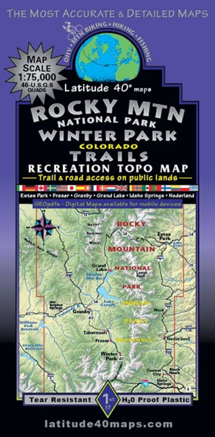
Rocky Mountain National Park – Winter Park Trails Hiking Map
Rocky Mountain National Park – Winter Park Trails Hiking Map
Regular price
$14.95 USD
Regular price
Sale price
$14.95 USD
Unit price
per
Shipping calculated at checkout.
Low stock
Couldn't load pickup availability
- SKU: LAT40_RMNP_WIN_23
- Rocky Mountain National Park (RMNP) has more visitation than possibly anywhere in Colorado, most of the visitors are day tourists and don’t really get too far into the backcountry on their dayhikes. A few trailheads south of the park also get loved to death on the weekends during the summer, but most of the millions of people living within 20-60 miles of the Front Range Continental Divide (CT) hardly even visit the high country. There are still many opportunities for solitude. There are hundreds of designated system routes shown within the Roosevelt, Arapaho and Routt National Forests. Public access trail and road information for all user groups with mileage between junctions and route difficulty ratings. This map is way more than just a RMNP map, it covers a vast area west of the CT. The western slope is far less visited by comparison. Two-sided map covers ~58 miles north to south from the northern boundary of RMNP, south to the town of Idaho Springs on I-80. East to west for 42 miles from 5 miles east of the town of Estes Park, west to 5 miles west of the town of Hot Sulfur Springs on the Colorado River. Trailheads, campgrounds, dispersed camping, picnic areas, day use areas, parking/pullouts, mtn. huts, cabins and yurts. As well as hot springs, locations of mines, adits and caves, remnants of old mills and mining camps, ghost towns, historical townsites and points of interest, special geologic areas and scenic viewpoints/overlooks. Includes Byers Peak, Indian Peaks, James Pk., Never Summer and Vasquez Wildernesses and portions of Comanche Pk., Neota, Ptarmigan Pk. and Rawah Wilderness Areas, Arapaho National Recreation Area (including Lake Granby and Shadow Mtn. Res.), Colorado State Forest State Park, State Wildlife Areas and State Trust Lands. Ski area summer trails for hiking and mountain biking. OHV routes and dispersed camping in the vicinity of SH 125 north of the town of Granby. Includes the Peak to Peak Scenic Byway (State Hwys. 7, 72 and 119) from Central City/Black Hawk through Nederland to Estes Park, up and over the Continental Divide (-10,758’) on Trail Ridge Rd. Scenic Byway (through RMNP) descending into Grand Lake and down the Colorado River Headwaters Scenic Byway. Scenic route continues on Hwy. 40 through Granby and Winter Park, over Berthoud Pass to I-70 eastbound through Idaho Springs, turn left on to the Central City Parkway to Central City and Blackhawk and Hwy.119. A super scenic, paved highway tour…. an incredible Colorado high country experience with amazing viewpoints, trailheads and trail access along the 190 mile route. Reference our regional map, Front Range Trails to connect and follow routes that extend beyond this maps boundaries. West side of map overlaps Steamboat-Routt National Forest Trails at the same scale 1;75,000 or 1”= 1.2 miles.
- Type: Folded Map
- Subtype: Hiking
- Language: English
- Publication Date: 2023-06-01
- Scale: 1:75,000
- Regions Covered: Central U.S., North America
- Countries Covered: United States
- States Covered: Colorado
- ISBN: 9781879866362
- Folded Size: 4" (W) x 8" (H)
- Unfolded Size: 25" (W) x 39" (H)
- Weight: 3 oz