Fish-n-Map Company
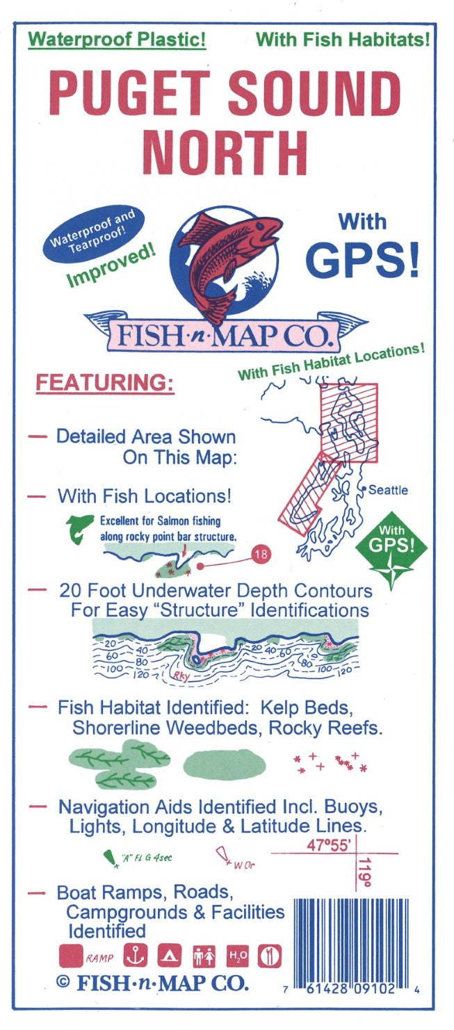
Puget Sound North (Everett to Deception Pass) Fishing Map
Puget Sound North (Everett to Deception Pass) Fishing Map
Couldn't load pickup availability
- SKU: FNM_PUG_N_21
Fish-N-Map Company underwater topography maps are printed on a waterproof, tear-resistant material and are folded to 9" x 4". When opened, each map is approximately 3' x 2' in size and is printed on both sides. These maps feature waterproof plastic "paper"; underwater depth contours; fish locations; latitude and longitude for GPS; often multiple lakes on one map; boat ramps; recreational facilities; and much more.
2021 UPDATES:
Added an additional color - green
Added shallow submerged weedbeds and additional kelp beds
Updated outline of shoreline where needed
Updated the boat ramp listing and locations
Updated the marina listings and their locations
FEATURES:
20 foot depth contours
Underwater features identified including wrecks, weedbeds, artificial reefs, underwater bottom conditions, dredged channels
Latitude and Longitude Grids with Over 100 GPS Coordinates Identified
Numerous Fish Locations presented throughout chart
Fishing Strategy included
Artificial Reef Data
Detailed Areas of Deception Pass, Admiralty Head and Possession Bar
Boat ramps, Campgrounds and Facilities provided
Waterproof and Tear-resistant plastic, folds to 9" x 4", unfolds to 3' x 2', 2-sided chart
MADE IN THE U.S.A.- Type: Folded Map
- Subtype: Fishing
- Language: English
- Publication Date: 2021-06-01
- Scale: Scale not provided
- Regions Covered: North America, Northwestern U.S.
- Countries Covered: United States
- States Covered: Washington
- UPC: 761428091024
- Folded Size: 4" (W) x 9" (H)
- Unfolded Size: 36" (W) x 24" (H)
- Weight: 1.8 oz