Tom Patterson Maps
Prince William Sound, Alaska - Paper
Prince William Sound, Alaska - Paper
Regular price
$45.00 USD
Regular price
Sale price
$45.00 USD
Unit price
per
Shipping calculated at checkout.
Couldn't load pickup availability
- SKU: PODTP_PWS
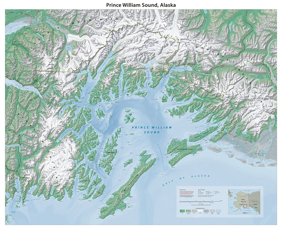
- As a cartographer and admirer of Alaskan landscapes, I have always been fascinated by the mosaic of islands, fjords, glaciers, and mountains of Prince William Sound. This is the most laborious map that I have ever made. The culprit: climate change. Although much of the data that went into making the map was of recent vintage, glaciers in the region have melted noticeably these last few years. Columbia Glacier, for example, receded three miles (4.8 kilometers) between 2019 and the most recent update in 2025. Map features include towns, points of interest, bathymetry, land cover, and shaded relief with rock textures. Elevations are in feet. Standard Matte Paper (Archival Map Print) Printed on our standard high-quality matte paper, this option offers excellent color accuracy and fine detail with a smooth, non-reflective finish. The matte surface minimizes glare, making it ideal for reading, studying, and framing under glass. FSC-certified and well-suited for both wall display and frequent reference. Best for: Everyday wall maps, educational use, libraries, offices, and framing.
- Subtype: Wall Art
- Language: English
- Scale: 1:250000
- Folded Size: N/A
- Unfolded Size: 44" (W) x 36" (H)