USSR Ministry of Defense
Portland, ME 1 (USA) - Soviet Military City Plans
Portland, ME 1 (USA) - Soviet Military City Plans
Regular price
$49.95 USD
Regular price
Sale price
$49.95 USD
Unit price
per
Shipping calculated at checkout.
Couldn't load pickup availability
- SKU: SUAA-PORTLANDME1-P
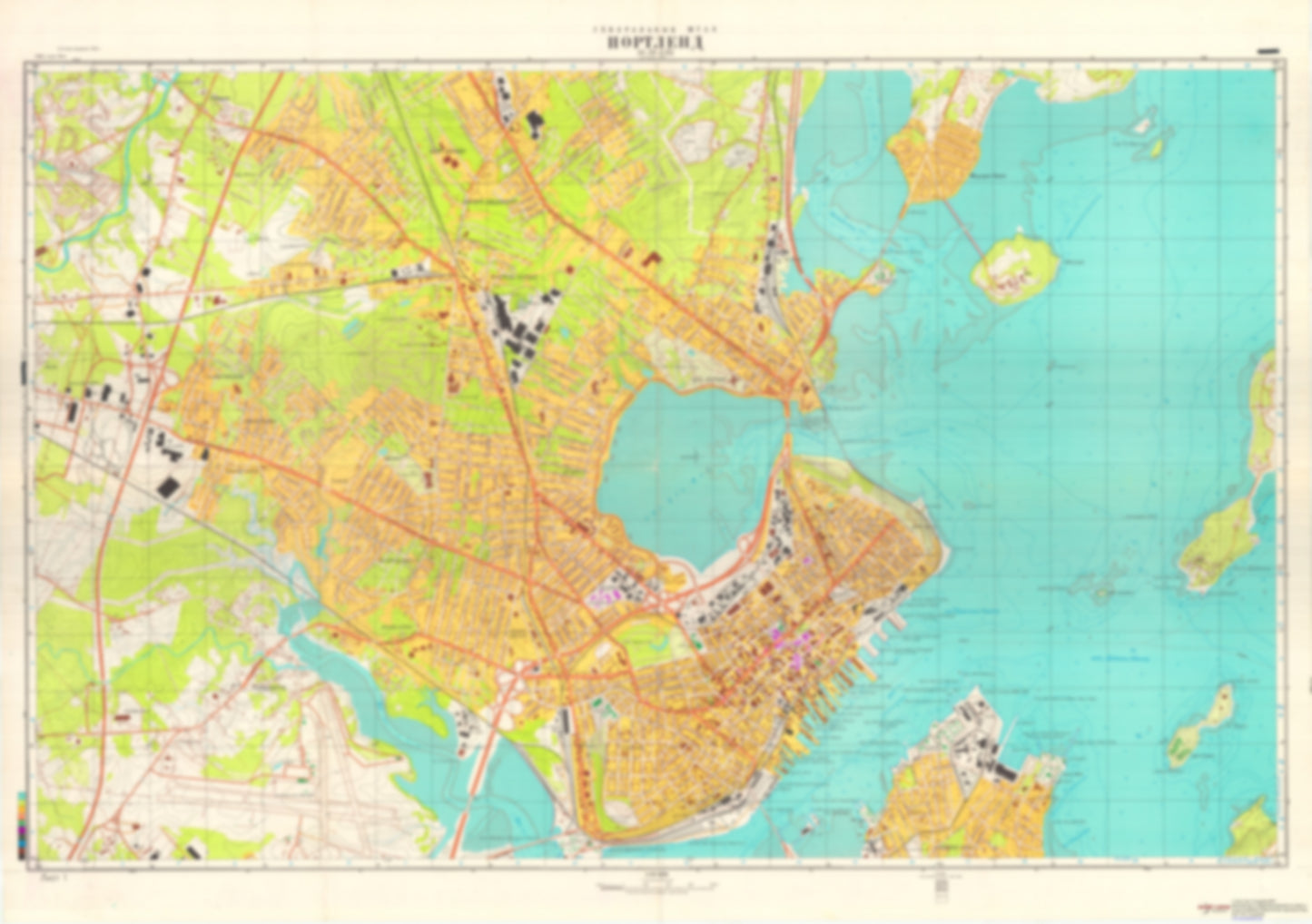
- During the Cold War and before easy access to high-resolution satellite imagery, The Soviet Military was secretly mapping the entire world. These aesthetically striking maps are beautiful down to the last detail and fantastic wall art and until now, have rarely been viewed or available to outsiders. This series has been covered by Wired Magazine and Greg Miller in his book, "All Over the Map: A Cartographic Odyssey". This map is part of the Soviet City Plans Series presented by East View, which has the largest collection of Soviet Military City Plans in the world. The Soviet Military City Plan(s) of Portland, ME 1 (USA) is one in a series of highly detailed topographic city maps developed by the USSR Ministry of Defense during the Cold War era. These collectable, high resolution print-on-demand editions are delivered on premium, acid-free, matte paper. This item is sheet number 1 in a set of 2 sheet(s) for Portland, ME Military and Defense: Coast Guard Base South Portland Landmarks and Natural Features: Blueberry Hill, Cushing Point, Deer Hill, Fish Point, Fort Hill, Fort Scammel Point, Graves Hill, House Island, Little Diamond Island, Mackworth Island, Mackworth Point, Martin Point, Prospect Hill, Rocky Hill, Spring Point, The Brothers, Thompson Point, West Shore Sandy Beach, Willard Beach Water Bodies: Back Cove, Diamond Island Roads, Lamson Cove, Stroudwater River Reservoir
- Type: Map
- Subtype: City Plan
- Language: Russian
- Publication Date: 1984-06-01
- Scale: 1:10,000
- Regions Covered: Mid-Atlantic/Northeastern U.S., North America
- Countries Covered: United States
- States Covered: Maine
- MPN: PORTLAND ME 1
- Folded Size: N/A
- Unfolded Size: 46.1" (W) x 32.5" (H)
- Weight: 4.8 oz