Tom Patterson Maps
Physical Features of North America - Metric - Premium Photo Paper
Physical Features of North America - Metric - Premium Photo Paper
Regular price
$100.00 USD
Regular price
Sale price
$100.00 USD
Unit price
per
Shipping calculated at checkout.
Couldn't load pickup availability
- SKU: PODTP_N_AM_PHY_METR_EPS
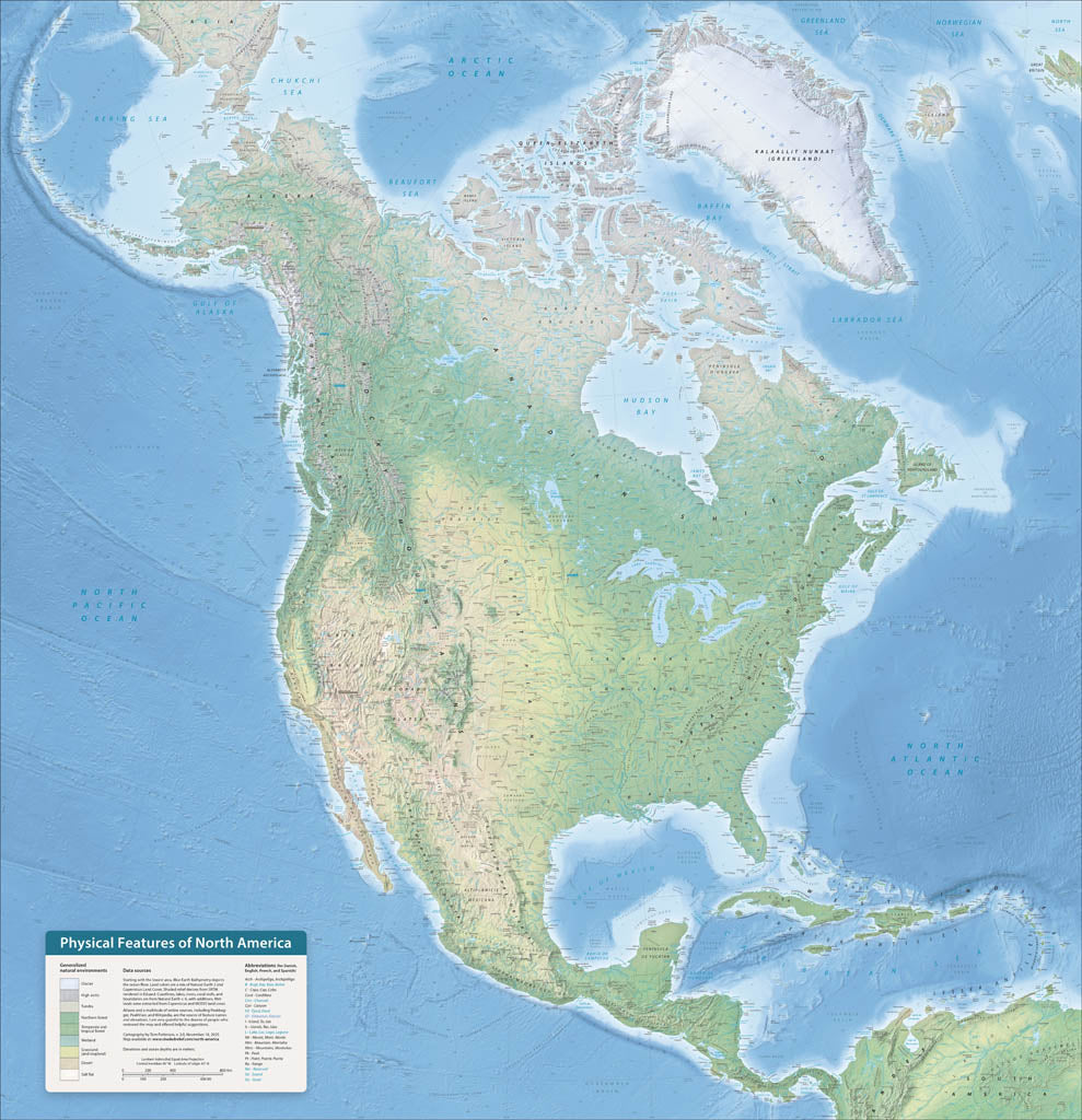
- North America is an ideal continent for physical mapping. The irregular coast, varied terrain, and diverse environments form a cartographic mosaic of colors and textures. These features tell geographic stories. The cordillera running along the entire Pacific coast gives evidence of the theory of plate tectonics. And looking south from Canada’s arctic islands to Panama’s rain forests, we see the influence of latitude and elevation on natural vegetation. I first made this map during the winter of 2020-21 to keep busy during the pandemic. This new version, completely rebuilt from Natural Earth v.6 data and with terrain rendered in Eduard software, is more accurate, detailed, and prettier. Elevations are in meters. Premium Luster Photo Paper (Gallery-Quality Print) Printed on Epson Premium Luster Photo Paper, this is our highest-end paper option. It delivers exceptionally rich color, deep blacks, and crisp detail with a subtle satin-luster finish that reduces glare while maintaining photographic depth. This premium stock is designed for presentation-quality prints and professional display. Best for: Collector pieces, presentation maps, exhibitions, and premium framing.
- Subtype: Wall Art
- Language: English
- Scale: 1:8500000
- Folded Size: N/A
- Unfolded Size: 42" (W) x 43.4" (H)