Tom Patterson Maps
Physical Features of North America - Imperial - Laminated
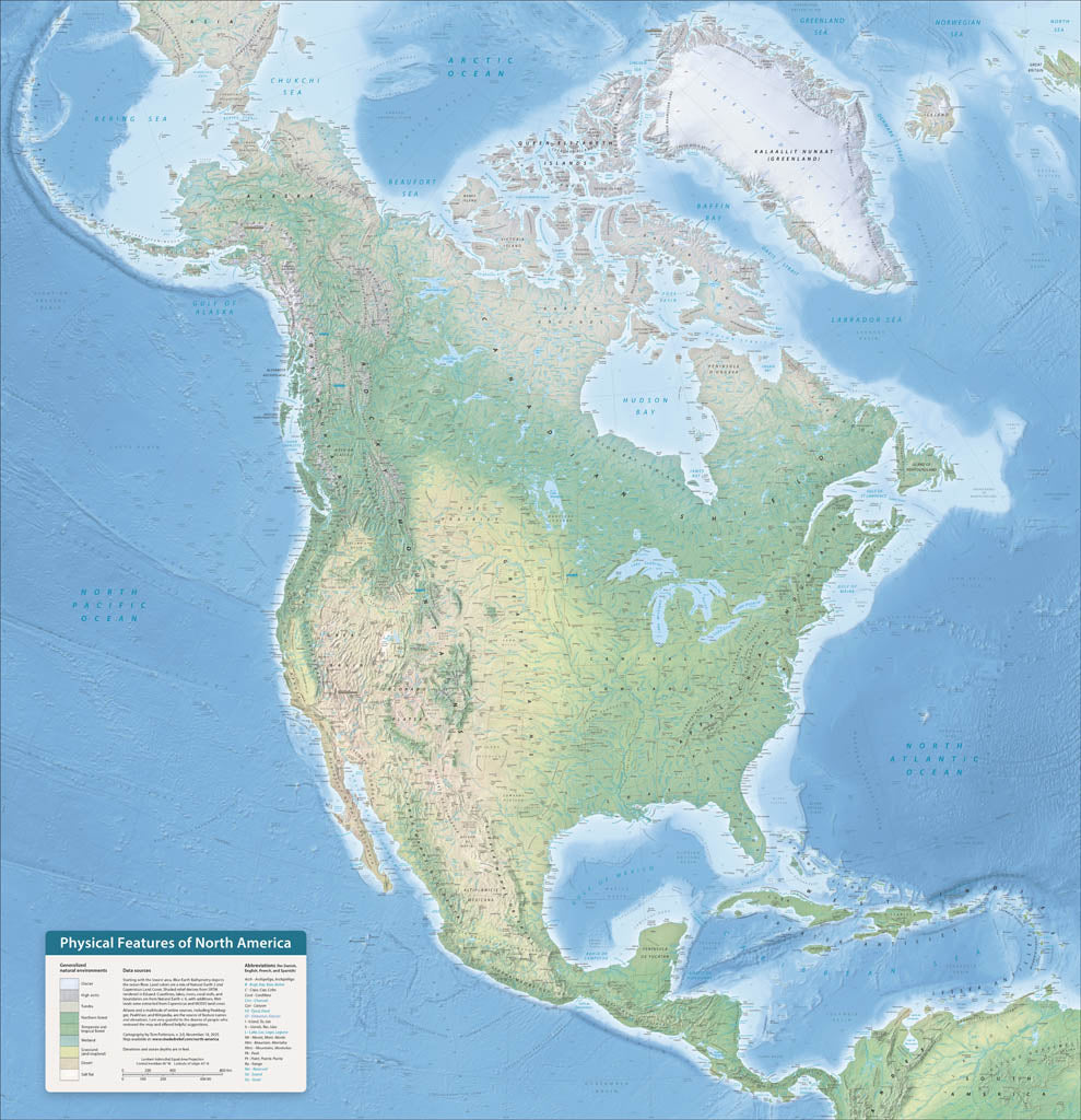
Physical Features of North America - Imperial - Laminated
Regular price
$60.00 USD
Regular price
Sale price
$60.00 USD
Unit price
per
Shipping calculated at checkout.
Couldn't load pickup availability
- SKU: PODTP_N_AM_PHY_IMP_LAM
- North America is an ideal continent for physical mapping. The irregular coast, varied terrain, and diverse environments form a cartographic mosaic of colors and textures. These features tell geographic stories. The cordillera running along the entire Pacific coast gives evidence of the theory of plate tectonics. And looking south from Canada’s arctic islands to Panama’s rain forests, we see the influence of latitude and elevation on natural vegetation. I first made this map during the winter of 2020-21 to keep busy during the pandemic. This new version, completely rebuilt from Natural Earth v.6 data and with terrain rendered in Eduard software, is more accurate, detailed, and prettier. Elevations are in feet. Gloss Laminated Paper (Durable, High-Impact Finish) This option begins with our standard matte paper and is finished with a professional gloss laminate. The lamination enhances color vibrancy and contrast while adding durability and moisture resistance. The glossy surface is easy to wipe clean and helps protect the map from handling, making it ideal for long-term use. Best for: Classrooms, public spaces, field use, planning environments, and high-traffic areas.
- Subtype: Wall Art
- Language: English
- Scale: 1:8500000
- Folded Size: N/A
- Unfolded Size: 42" (W) x 43.4" (H)