Tom Patterson Maps
Physical Features of Africa - Paper
Physical Features of Africa - Paper
Regular price
$60.00 USD
Regular price
Sale price
$60.00 USD
Unit price
per
Shipping calculated at checkout.
Couldn't load pickup availability
- SKU: PODTP_AFR_PHY
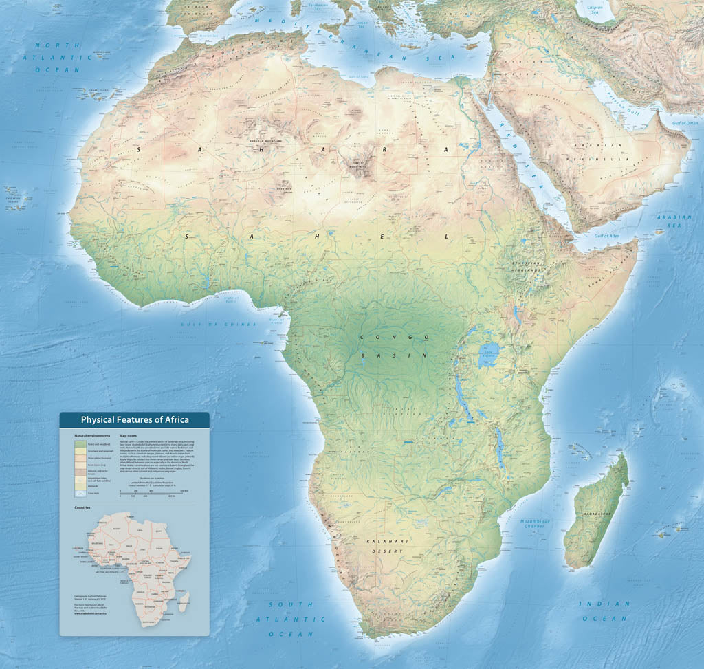
- With over 4,000 labels, this map highlights the diverse physical features of Earth's second-largest continent. Follow the course of the Nile, Earth's longest river, and the Great Rift Valley where the continent is splitting apart due to plate tectonics. Natural colors depict latitudinally-influenced environmental zones, including Mediterranean woodland, desert, rain forest, and expanses of savannah everywhere else. Other map elements include bathymetric labels in the oceans, callouts indicating major river sources, country borders, and major cities. Elevations are in meters. Standard Matte Paper (Archival Map Print) Printed on our standard high-quality matte paper, this option offers excellent color accuracy and fine detail with a smooth, non-reflective finish. The matte surface minimizes glare, making it ideal for reading, studying, and framing under glass. FSC-certified and well-suited for both wall display and frequent reference. Best for: Everyday wall maps, educational use, libraries, offices, and framing.
- Subtype: Wall Art
- Language: English
- Scale: 1:3700000
- Folded Size: N/A
- Unfolded Size: 50" (W) x 47.6" (H)