Tom Patterson Maps
Physical Features of Africa - Matte Laminated
Physical Features of Africa - Matte Laminated
Regular price
$90.00 USD
Regular price
Sale price
$90.00 USD
Unit price
per
Shipping calculated at checkout.
Couldn't load pickup availability
- SKU: PODTP_AFR_PHY_MATTE
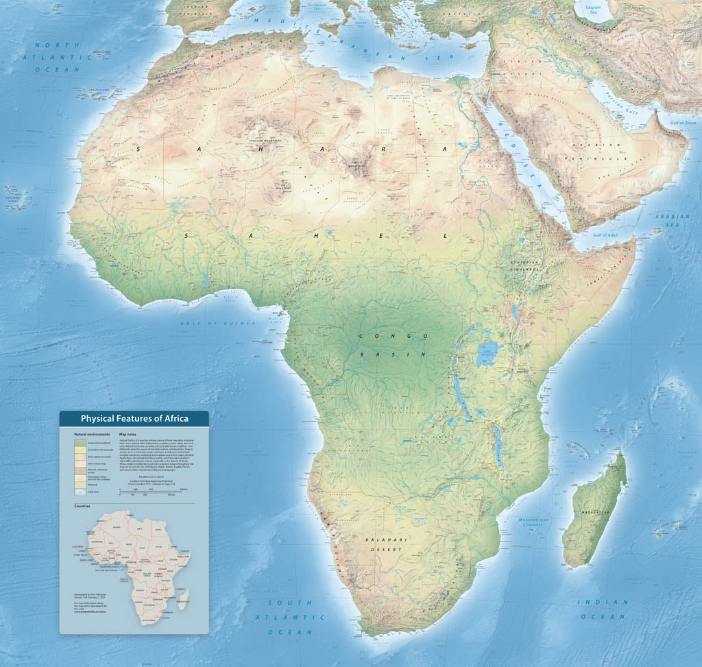
- With over 4,000 labels, this map highlights the diverse physical features of Earth's second-largest continent. Follow the course of the Nile, Earth's longest river, and the Great Rift Valley where the continent is splitting apart due to plate tectonics. Natural colors depict latitudinally-influenced environmental zones, including Mediterranean woodland, desert, rain forest, and expanses of savannah everywhere else. Other map elements include bathymetric labels in the oceans, callouts indicating major river sources, country borders, and major cities. Elevations are in meters. Matte Laminated Paper (Low-Glare, Extra Durable) Printed on our standard high-quality matte paper and finished with a professional matte laminate, this option adds durability and protection while preserving a soft, low-glare appearance. The laminated surface resists moisture, fingerprints, and scuffs without introducing shine, making it ideal where readability and longevity matter most. Best for: Planning rooms, classrooms, offices, public installations, and maps that will be handled frequently or displayed under bright lighting.
- Subtype: Wall Art
- Language: English
- Scale: 1:3700000
- Folded Size: N/A
- Unfolded Size: 50" (W) x 47.6" (H)