Tom Patterson Maps
Physical Features of Africa - Gloss Laminated
Physical Features of Africa - Gloss Laminated
Regular price
$75.00 USD
Regular price
Sale price
$75.00 USD
Unit price
per
Shipping calculated at checkout.
Couldn't load pickup availability
- SKU: PODTP_AFR_PHY_GLOSS
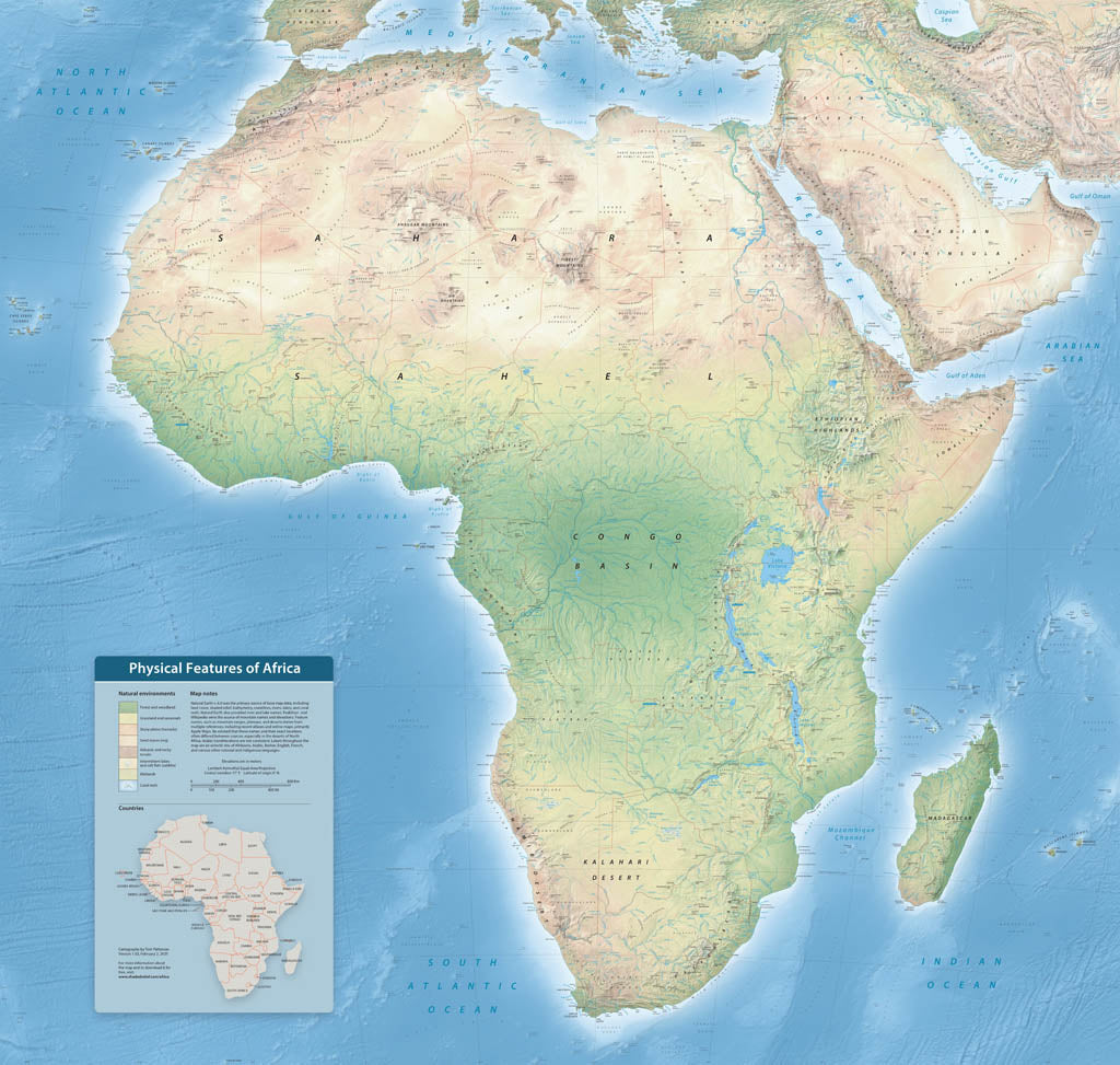
- With over 4,000 labels, this map highlights the diverse physical features of Earth's second-largest continent. Follow the course of the Nile, Earth's longest river, and the Great Rift Valley where the continent is splitting apart due to plate tectonics. Natural colors depict latitudinally-influenced environmental zones, including Mediterranean woodland, desert, rain forest, and expanses of savannah everywhere else. Other map elements include bathymetric labels in the oceans, callouts indicating major river sources, country borders, and major cities. Elevations are in meters. Gloss Laminated Paper (Durable, High-Impact Finish) This option begins with our standard matte paper and is finished with a professional gloss laminate. The lamination enhances color vibrancy and contrast while adding durability and moisture resistance. The glossy surface is easy to wipe clean and helps protect the map from handling, making it ideal for long-term use. Best for: Classrooms, public spaces, field use, planning environments, and high-traffic areas.
- Subtype: Wall Art
- Language: English
- Scale: 1:3700000
- Folded Size: N/A
- Unfolded Size: 50" (W) x 47.6" (H)