USSR Ministry of Defense
Philadelphia, Camden, PA 3 (USA) - Soviet Military City Plans
Philadelphia, Camden, PA 3 (USA) - Soviet Military City Plans
Regular price
$49.95 USD
Regular price
Sale price
$49.95 USD
Unit price
per
Shipping calculated at checkout.
Couldn't load pickup availability
- SKU: SUAA-PHILADELPHIA-CAMDEN3-P
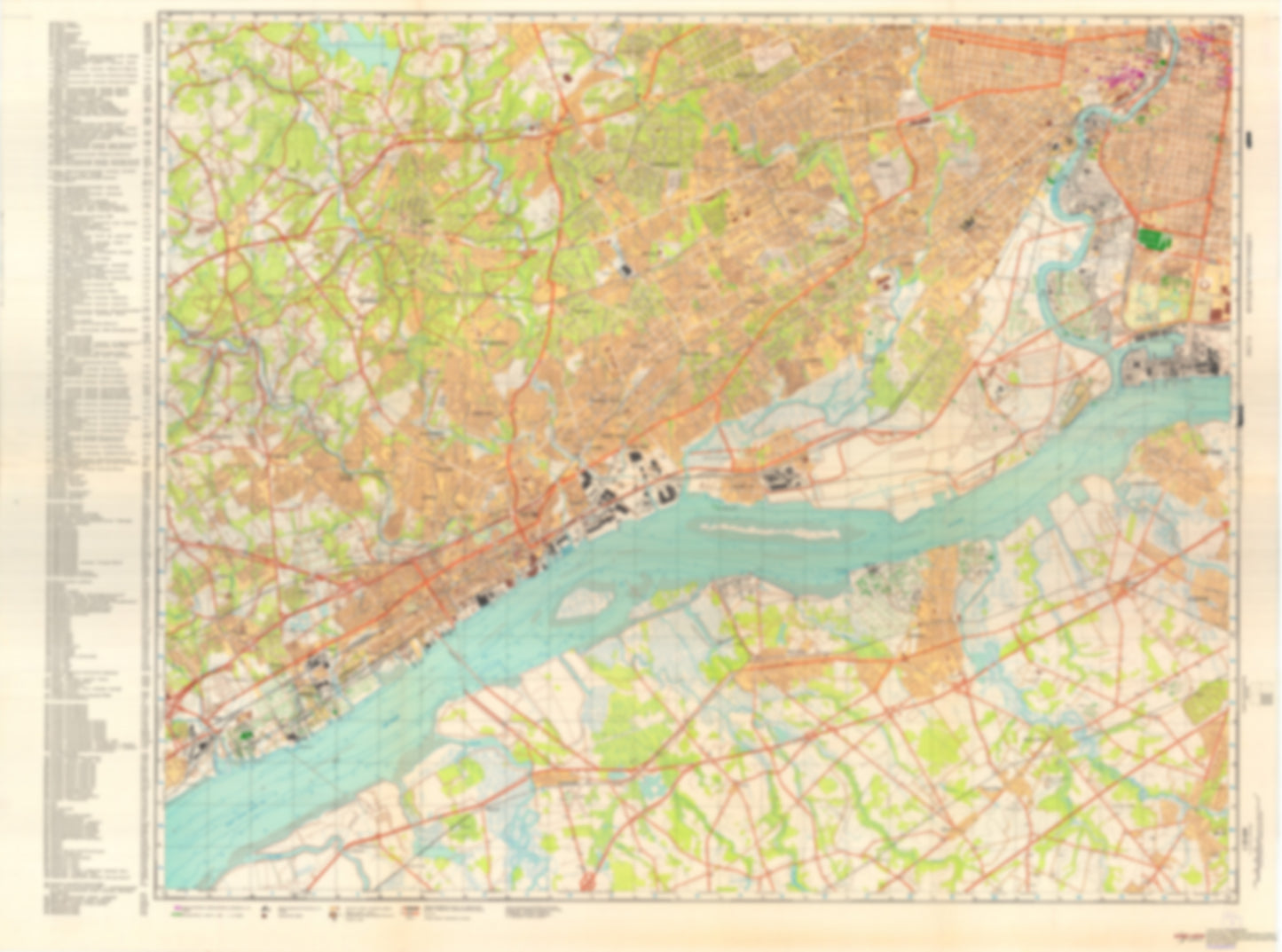
- During the Cold War and before easy access to high-resolution satellite imagery, The Soviet Military was secretly mapping the entire world. These aesthetically striking maps are beautiful down to the last detail and fantastic wall art and until now, have rarely been viewed or available to outsiders. This series has been covered by Wired Magazine and Greg Miller in his book, "All Over the Map: A Cartographic Odyssey". This map is part of the Soviet City Plans Series presented by East View, which has the largest collection of Soviet Military City Plans in the world. The Soviet Military City Plan(s) of Philadelphia, Camden, PA 3 (USA) is one in a series of highly detailed topographic city maps developed by the USSR Ministry of Defense during the Cold War era. These collectable, high resolution print-on-demand editions are delivered on premium, acid-free, matte paper. This item is sheet number 3 in a set of 4 sheet(s) for Philadelphia, Camden, PA Populated Places: City of Chester, Delaware County, Township of Aston, Township of Chester, Township of Darby, Township of East Greenwich, Township of Greenwich, Township of Logan, Township of Lower Chichester, Township of Middletown, Township of Nether Providence, Township of Ridley, Township of Springfield, Township of Tinicum, Township of Upper Chichester, Township of Upper Darby, Township of Upper Providence, Township of West Deptford Military and Defense: Naval Base Philadelphia, Naval Hospital Philadelphia Parks and Reservations: Mud Island Landmarks and Natural Features: Bramell Point, Calcon Hook (historical), Chester Island, Crab Point, Eagle Point, Gibson Point, Girard Point, Greenwich Island, Harkness Point, Hay Island, Hog Island, Hunting Hill, Little Tinicum Island, Lodge Point, Long Point, Monds Island, Point Breeze, Province Island, Raccoon Island, Smith Island, Thompson Point, Tinicum Island (historical), Washington Point Neck, Yankee Point Water Bodies: Bell Lake, Billingsport Range, Billingsport Range, Broomalls Lake, Chester Range, Chester Range, Cooper Lake, Crum Creek Reservoir, Eagle Point Range, Eagle Point Range, Eddystone Range, Eddystone Range, Fort Mifflin Disposal Area, Greenwich Lake, Marcus Hook Range, Meadow Lake, Mifflin Range, Reserve Basin, Ridley Park Lake, Springton Reservoir, Tinicum Range, Tinicum Range
- Type: Map
- Subtype: City Plan
- Language: Russian
- Publication Date: 1974-06-01
- Scale: 1:25,000
- Regions Covered: Mid-Atlantic/Northeastern U.S., North America
- Countries Covered: United States
- States Covered: Pennsylvania
- MPN: PHILADELPHIA, CAMDEN 3
- Folded Size: N/A
- Unfolded Size: 47.7" (W) x 35.5" (H)
- Weight: 4.8 oz