Rand McNally
Philadelphia and Southeast Pennsylvania, Pennsylvania
Philadelphia and Southeast Pennsylvania, Pennsylvania
Regular price
$9.99 USD
Regular price
Sale price
$9.99 USD
Unit price
per
Shipping calculated at checkout.
Couldn't load pickup availability
- SKU: RM_PHILA_VIC_25
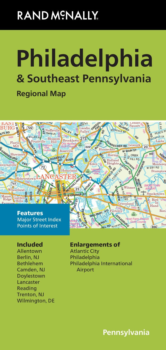
Rand McNally's folded map for Philadelphia & Southeast Pennsylvania is a must-have for anyone traveling in and around this part of Ohio, offering unbeatable accuracy and reliability at a great price. Our trusted cartography shows all Interstate, U.S., state, and county highways, along with clearly indicated parks, points of interest, airports, county boundaries, and streets. The easy-to-use legend and detailed index make for quick and easy location of destinations. You'll see why Rand McNally folded map have been the trusted standard for years.
- Regularly updated
- Full-color maps
- Clearly labeled Interstate, U.S., state, and county highways
- Indications of parks, points of interest, airports, county boundaries, downtown & vicinity maps
- Major attractions & Golf Courses
- Enlargements of Atlantic City, Philadelphia, Philadelphia International Airport
- Easy-to-use legend
- Detailed index & Major Street Index
- Convenient folded size
- Copyright 2025
Coverage Area
Allentown, Berlin NJ, Bethlehem, Camden NJ, Doylestown, Lancaster, Reading, Trenton NJ, Wilmington, DE
Product Details
Measures 9.5" x 4" and folds out to 40" x 28"
- Type: Folded Map
- Subtype: City Maps
- Language: English
- Publication Date: 2025-12-01
- Scale: 1:158,400
- Regions Covered: Mid-Atlantic/Northeastern U.S., North America
- Countries Covered: United States
- States Covered: Pennsylvania
- ISBN: 9780528029974
- UPC: 70609008141
- Folded Size: 4.33" (W) x 9.06" (H)
- Unfolded Size: 27.56" (W) x 39.37" (H)
- Weight: 2 oz