USSR Ministry of Defense
Perth 2 (Australia) - Soviet Military City Plans
Perth 2 (Australia) - Soviet Military City Plans
Regular price
$49.95 USD
Regular price
Sale price
$49.95 USD
Unit price
per
Shipping calculated at checkout.
Couldn't load pickup availability
- SKU: SUAA-PERTH_2-P
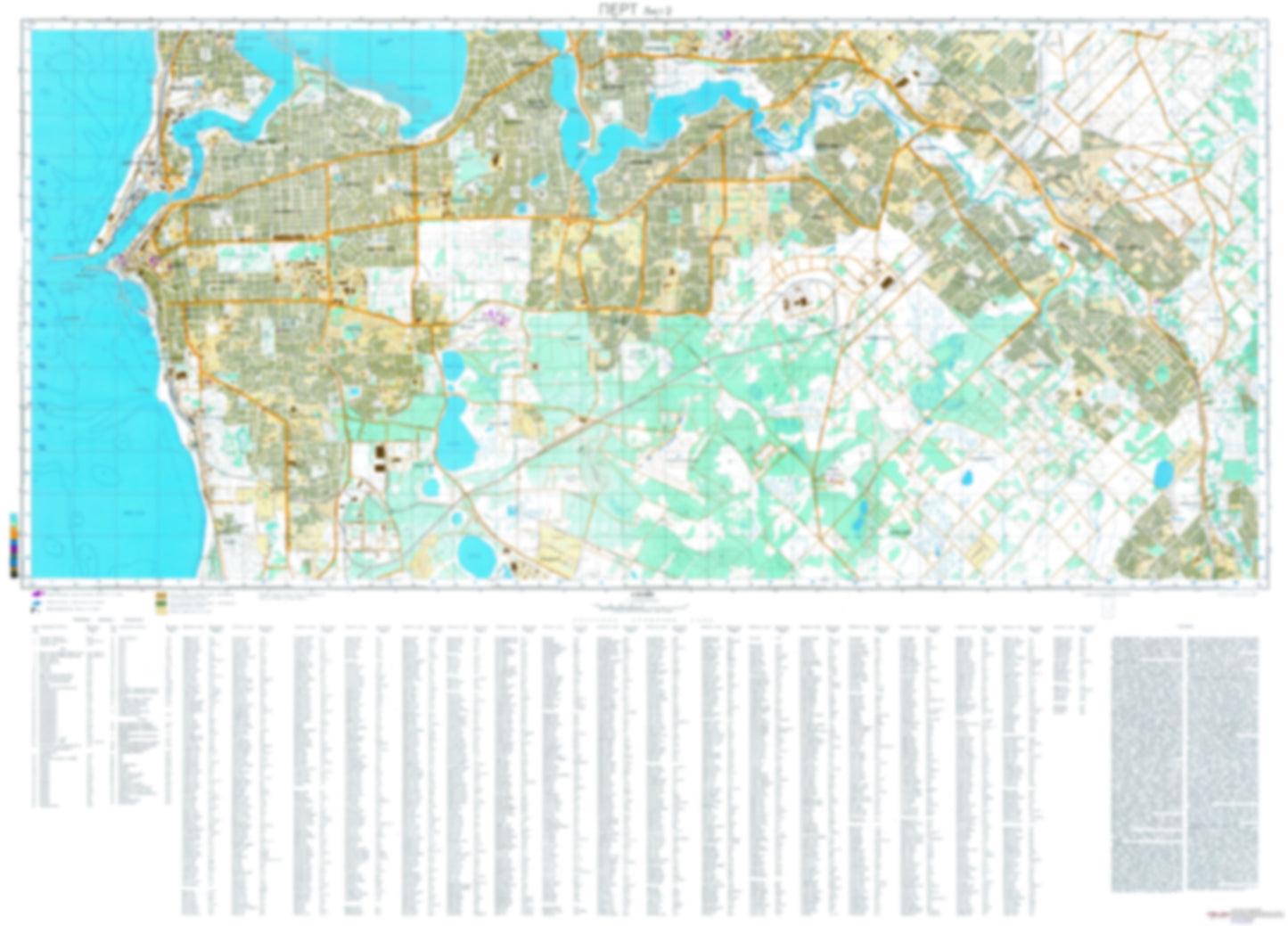
- During the Cold War and before easy access to high-resolution satellite imagery, The Soviet Military was secretly mapping the entire world. These aesthetically striking maps are beautiful down to the last detail and fantastic wall art and until now, have rarely been viewed or available to outsiders. This series has been covered by Wired Magazine and Greg Miller in his book, "All Over the Map: A Cartographic Odyssey". This map is part of the Soviet City Plans Series presented by East View, which has the largest collection of Soviet Military City Plans in the world. The Soviet Military City Plan(s) of Perth 2 (Australia) is one in a series of highly detailed topographic city maps developed by the USSR Ministry of Defense during the Cold War era. These collectable, high resolution print-on-demand editions are delivered on premium, acid-free, matte paper. This item is sheet number 2 in a set of 2 sheet(s) for Perth Populated Places: Applecross, Attadale, Bicton, Cannington, Coogee, East Fremantle, Fremantle, Gosnells, Kelmscott, Kenwick, Maddington, North Fremantle, Spearwood Landmarks and Natural Features: All Saints College, Aquinas College, Arthur Head, Australian Islamic College, Bathers Beach, C Y O'Connor Beach, Canning College, Canning Vale College, Cannington Community College, Carey Baptist College, Catherine Point, Chidley Point, Christian Brothers College, Clontarf Aboriginal College, Coogee Beach, Corpus Christi College, Edwards Matriculation College, Iona Presentation College, John Curtin College of the Arts, Kelmscott Secondary College, Leighton Beach, Lumen Christi College, Mosman Beach, Point Dundas, Point Roe Water Bodies: Aquinas Bay, Bathers Bay, Bibra Lake, Booragoon Lake, Champion Lakes, Crab Bay, Lake Bibra, Lake Gillon, Little Rush Lake, Lucky Bay, Manning Lake, Mosman Bay, North Lake, Rock Bay, Rocky Bay, South Lake, Wright Lake, Yangebup Lake
- Subtype: City Plan
- Language: Russian
- Publication Date: 1985-06-01
- Scale: 1:25,000
- Countries Covered: Australia
- MPN: PERTH_2
- Folded Size: N/A
- Unfolded Size: 48" (W) x 34.5" (H)
- Weight: 4.8 oz