Fish-n-Map Company
Pend Oreille Lake, ID Fishing Map
Pend Oreille Lake, ID Fishing Map
Couldn't load pickup availability
- SKU: FNM_PEND_OREI_22
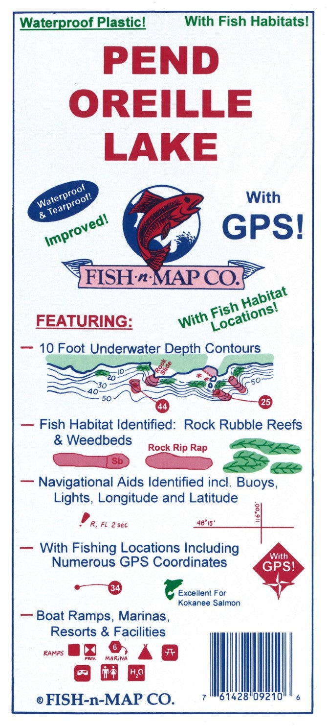
This map shows underwater topographic details for Pend Oreille Lake. The map features: - 10 foot underwater contours - Navigational Aids Identified, including buoys, lights, longitude, and latitude - Boat ramps, marinas, resorts, and facilities - With fishing locations including numerous GPS coordinates
Features:
• Fish habitat added (weed beds, rock rubble reefs and slab rock)
• All new Fishing Locations and Fishing Strategy
• Longitude and Latitude Grids improved and now scaled using NAD 83 for the datum
• Updated GPS locations
• Aerial Photo Enhanced
• Marinas, Boat Ramps, Facilities and Roads Updated
• Now a multi-color map
10-Foot Underwater Depth Contours
Fish Habitat Identified (Rock Rubble Reefs and Weedbeds)
Multiple Fishing Suggestions and a Fishing Strategy Included
Numerous GPS Coordinates Provided
Latitude and Longitude Grids, Buoys and Lights Shown
Boat Ramps and Facilities Identified
Printed onto a waterproof, tear-resistant material. This double-sided map folds to 9" x 4" and unfolds to 3' x 2'.
MADE IN THE U.S.A.- Type: Folded Map
- Subtype: Fishing
- Language: English
- Publication Date: 2022-06-01
- Scale: 1:44,440
- Regions Covered: North America, North-central U.S./Great Plains
- Countries Covered: United States
- States Covered: Idaho
- UPC: 761428092106
- Folded Size: 3.94" (W) x 9.06" (H)
- Unfolded Size: 35.83" (W) x 23.62" (H)
- Weight: 3 oz