MapArt Publishing Corporation
Ottawa Large Folded Map
Ottawa Large Folded Map
Regular price
$5.95 USD
Regular price
Sale price
$5.95 USD
Unit price
per
Shipping calculated at checkout.
Couldn't load pickup availability
- SKU: CCC_OTTAWA_21
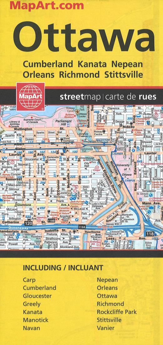
- Ottawa Large Folded Map - 20393 73% bigger than our regular folded maps this folded map of Ottawa includes detailed city mapping of the following communities at 1:25,000: Carp, Cumberland, Gloucester, Greely, Kanata, Manotick, Navan, Nepean, Orleans, Ottawa, Richmond, Rockcliffe Park, Stittsville and Vanier. Also includes a downtown map of Ottawa at 1:15,000 and a regional map at 1:800,000. Includes street indexes of each community, legend and the detailed city mapping has many features including Trans-Canada highway, divided highways, major roads, secondary roads, main thoroughfares, minor streets, lanes / private streets, interchange numbers, one way streets, street address numbers, railways, VIA Rail stations, O-Train and stations, Transitway and stations, bus stations, carpool parking, provincial boundaries, recreation trails, parks / conservation areas, golf courses, commercial areas, cemeteries, institutional areas, industrial areas, special attraction areas, National Defence, hospitals, tourist information centres, police stations, fire halls, municipal / regional buildings, courthouses, libraries, points of interest, off leash dog parks, beer stores, liquor stores, national parks / historic sites, arenas, community / recreation centres, pools, baseball, soccer, tennis, skiing, campground, public and catholic schools.
- Type: Folded Map
- Subtype: City Maps
- Language: English
- Publication Date: 2021-06-01
- Scale: 1:25,000
- Regions Covered: North America
- Countries Covered: Canada
- States Covered: Ontario
- ISBN: 9781553683933
- UPC: 66770203935
- MPN: 20393
- Folded Size: 5" (W) x 9" (H)
- Unfolded Size: 37" (W) x 48" (H)
- Weight: 3 oz