Ordnance Survey (Ireland)
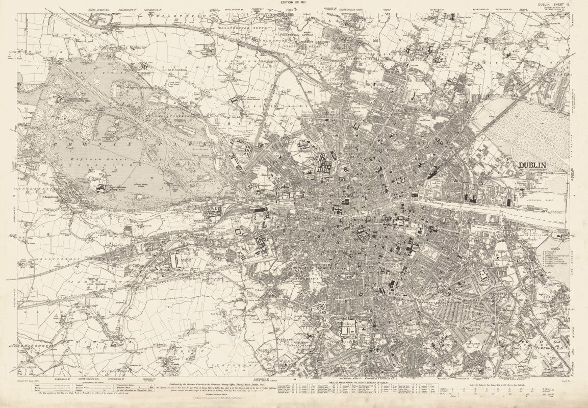
Ordnance Survey Six-Inch: 1837 Dublin, Ireland, Sheet 18 (Revised 1907-1908)
Ordnance Survey Six-Inch: 1837 Dublin, Ireland, Sheet 18 (Revised 1907-1908)
Regular price
$39.99 USD
Regular price
Sale price
$39.99 USD
Unit price
per
Shipping calculated at checkout.
Couldn't load pickup availability
- SKU: IOSOLD_DUB_18_1907
Reprint of the Ordnance Survey of Ireland's Six-Inch series that was produced between 1829 and 1969. Sheet 18 over Dublin covers most of modern-day Dublin stretching from St. Laurence Manor in the West to the Alexandra Basin in the East, and from Glasnevin in the North to Rathmines in the South.
Reproduced with the permission of the National Library of Scotland: https://maps.nls.uk/
- Type: Flat Map
- Subtype: Historical
- Language: English
- Publication Date: 1912-06-01
- Scale: 1:10,560
- Regions Covered: British Isles, Europe, Western Europe
- Countries Covered: Ireland
- MPN: 18
- Folded Size: N/A
- Unfolded Size: 42" (W) x 30" (H)