Tom Patterson Maps
Northern Antarctic Peninsula - Premium Photo Paper
Northern Antarctic Peninsula - Premium Photo Paper
Regular price
$100.00 USD
Regular price
Sale price
$100.00 USD
Unit price
per
Shipping calculated at checkout.
Couldn't load pickup availability
- SKU: PODTP_N_ANT_PEN_EPS
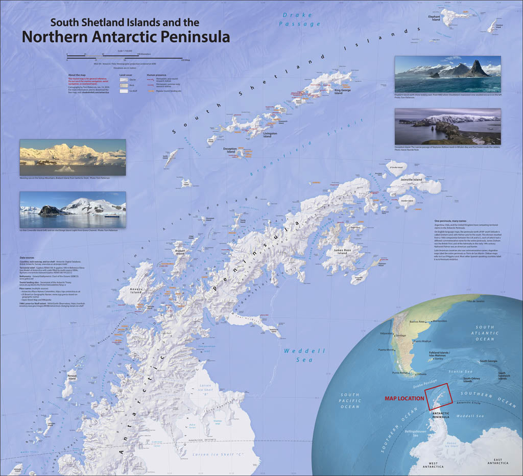
- On a visit to the Antarctic Peninsula and South Shetland Islands, I was disappointed by the available maps, which lacked coast detail and important place names. As a retired US National Park Service cartographer, I decided to improve matters by making a map similar to those that visitors get when entering a national park. Designing an accurate, informative, and easy-on-the-eyes reference map for ship passengers was my goal. I also wanted the map colors to reflect the Antarctic environment—icy waters brimming with life, glaciers everywhere, and rocky shores where penguins gather. In addition to physical features, this map shows research stations and tourist landing sites. Elevations are in meters. Premium Luster Photo Paper (Gallery-Quality Print) Printed on Epson Premium Luster Photo Paper, this is our highest-end paper option. It delivers exceptionally rich color, deep blacks, and crisp detail with a subtle satin-luster finish that reduces glare while maintaining photographic depth. This premium stock is designed for presentation-quality prints and professional display. Best for: Collector pieces, presentation maps, exhibitions, and premium framing.
- Subtype: Wall Art
- Language: English
- Scale: 1:750000
- Folded Size: N/A
- Unfolded Size: 41" (W) x 37.5" (H)