Tom Patterson Maps
Northern Antarctic Peninsula - Paper
Northern Antarctic Peninsula - Paper
Regular price
$45.00 USD
Regular price
Sale price
$45.00 USD
Unit price
per
Shipping calculated at checkout.
Couldn't load pickup availability
- SKU: PODTP_N_ANT_PEN
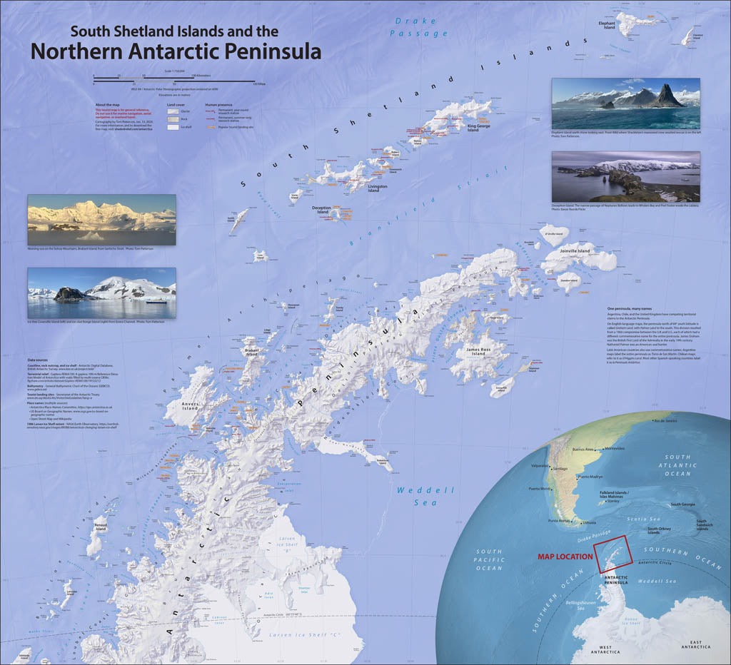
- On a visit to the Antarctic Peninsula and South Shetland Islands, I was disappointed by the available maps, which lacked coast detail and important place names. As a retired US National Park Service cartographer, I decided to improve matters by making a map similar to those that visitors get when entering a national park. Designing an accurate, informative, and easy-on-the-eyes reference map for ship passengers was my goal. I also wanted the map colors to reflect the Antarctic environment—icy waters brimming with life, glaciers everywhere, and rocky shores where penguins gather. In addition to physical features, this map shows research stations and tourist landing sites. Elevations are in meters. Standard Matte Paper (Archival Map Print) Printed on our standard high-quality matte paper, this option offers excellent color accuracy and fine detail with a smooth, non-reflective finish. The matte surface minimizes glare, making it ideal for reading, studying, and framing under glass. FSC-certified and well-suited for both wall display and frequent reference. Best for: Everyday wall maps, educational use, libraries, offices, and framing.
- Subtype: Wall Art
- Language: English
- Scale: 1:750000
- Folded Size: N/A
- Unfolded Size: 41" (W) x 37.5" (H)