Tom Patterson Maps
Northern Antarctic Peninsula - Laminated
Northern Antarctic Peninsula - Laminated
Regular price
$60.00 USD
Regular price
Sale price
$60.00 USD
Unit price
per
Shipping calculated at checkout.
Couldn't load pickup availability
- SKU: PODTP_N_ANT_PEN_LAM
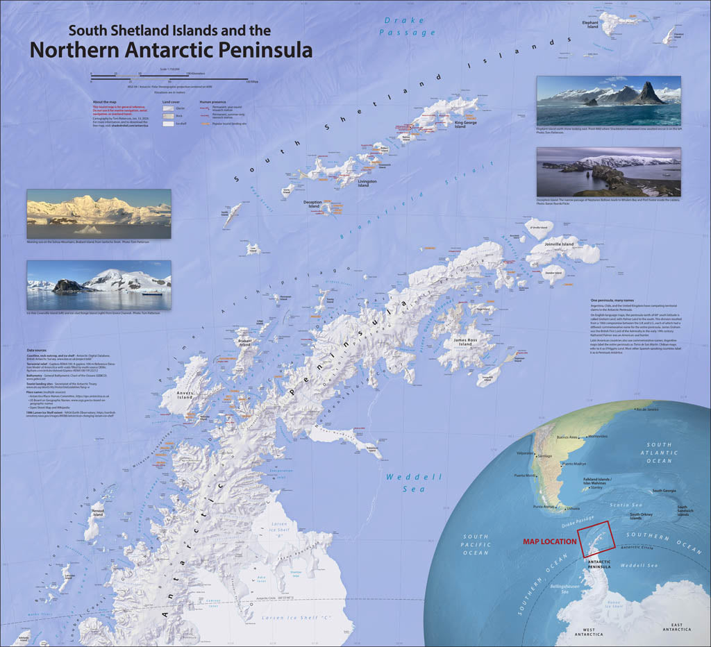
- On a visit to the Antarctic Peninsula and South Shetland Islands, I was disappointed by the available maps, which lacked coast detail and important place names. As a retired US National Park Service cartographer, I decided to improve matters by making a map similar to those that visitors get when entering a national park. Designing an accurate, informative, and easy-on-the-eyes reference map for ship passengers was my goal. I also wanted the map colors to reflect the Antarctic environment—icy waters brimming with life, glaciers everywhere, and rocky shores where penguins gather. In addition to physical features, this map shows research stations and tourist landing sites. Elevations are in meters. Gloss Laminated Paper (Durable, High-Impact Finish) This option begins with our standard matte paper and is finished with a professional gloss laminate. The lamination enhances color vibrancy and contrast while adding durability and moisture resistance. The glossy surface is easy to wipe clean and helps protect the map from handling, making it ideal for long-term use. Best for: Classrooms, public spaces, field use, planning environments, and high-traffic areas.
- Subtype: Wall Art
- Language: English
- Scale: 1:750000
- Folded Size: N/A
- Unfolded Size: 41" (W) x 37.5" (H)