Raven Maps
North Carolina Elevation Tints Fine Art Print Map
North Carolina Elevation Tints Fine Art Print Map
Regular price
$95.00 USD
Regular price
Sale price
$95.00 USD
Unit price
per
Shipping calculated at checkout.
Couldn't load pickup availability
- SKU: PODRP_NC_ELEV_44X20_WA
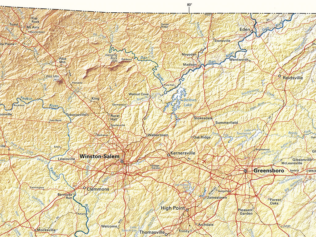
Our classic map of North Carolina uses elevation tints in subtle hues of green, tan, and brown to show the differences in elevation throughout the state, from sea level at the Atlantic Ocean to Mount Mitchell at 6,684'.
This North Carolina topographic map displays an incredible amount of detail, from cities, highways, and mountain ranges, to valleys, rivers, and small towns. The elevations of North Carolina are represented by color, and this, in combination with our special relief shading technique, gives the map a lush, 3-dimensional look.
Dimensions: All map dimensions are approximate.
- Type: Flat Map
- Subtype: Wall Art
- Language: English
- Regions Covered: North America, Southern U.S.
- Countries Covered: United States
- States Covered: North Carolina
- UPC: 767020013242
- MPN: northcarolina-elevation-tints-map
- Folded Size: N/A
- Unfolded Size: 44" (W) x 20" (H)
- Finish: Regular Paper