Tom Patterson Maps
North Atlantic Seafloor - Premium Photo Paper
North Atlantic Seafloor - Premium Photo Paper
Regular price
$80.00 USD
Regular price
Sale price
$80.00 USD
Unit price
per
Shipping calculated at checkout.
Couldn't load pickup availability
- SKU: PODTP_N_ATL_SEA_EPS
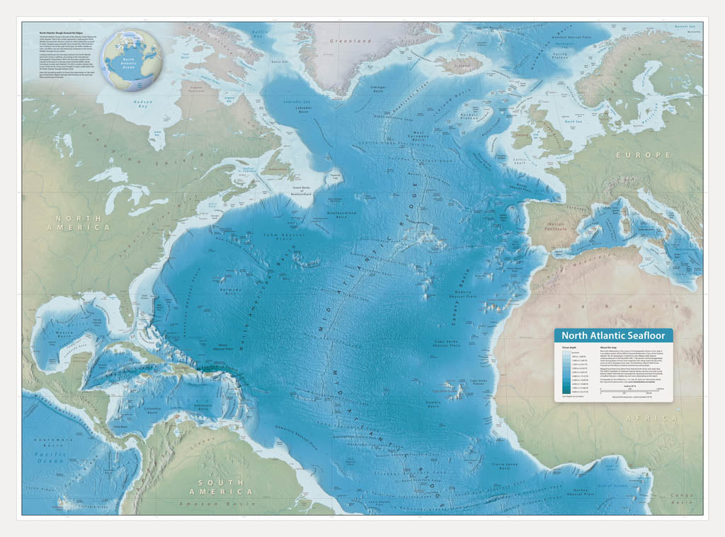
- This wall map showcases bottom features of the North Atlantic Ocean, including abyssal plains, banks, canyons, seamounts, trenches, and the scar-like Mid-Atlantic Ridge. On land, the map offers select coastal cities for reference. Blue Earth Bathymetry is the source of all topography shown on the map. It is an edited version of the GEBCO (General Bathymetric Chart of the Oceans) dataset. The 3D topography, rendered as plan oblique relief, depicts undersea features in partial profile with 1,100 percent vertical exaggeration. The GEBCO Gazetteer of Undersea Feature Names was the source for ocean bottom labels. Premium Luster Photo Paper (Gallery-Quality Print) Printed on Epson Premium Luster Photo Paper, this is our highest-end paper option. It delivers exceptionally rich color, deep blacks, and crisp detail with a subtle satin-luster finish that reduces glare while maintaining photographic depth. This premium stock is designed for presentation-quality prints and professional display. Best for: Collector pieces, presentation maps, exhibitions, and premium framing.
- Subtype: Wall Art
- Language: English
- Folded Size: N/A
- Unfolded Size: 41" (W) x 30.4" (H)