Tom Patterson Maps
North Atlantic Seafloor - Paper
North Atlantic Seafloor - Paper
Regular price
$25.00 USD
Regular price
Sale price
$25.00 USD
Unit price
per
Shipping calculated at checkout.
Couldn't load pickup availability
- SKU: PODTP_N_ATL_SEA
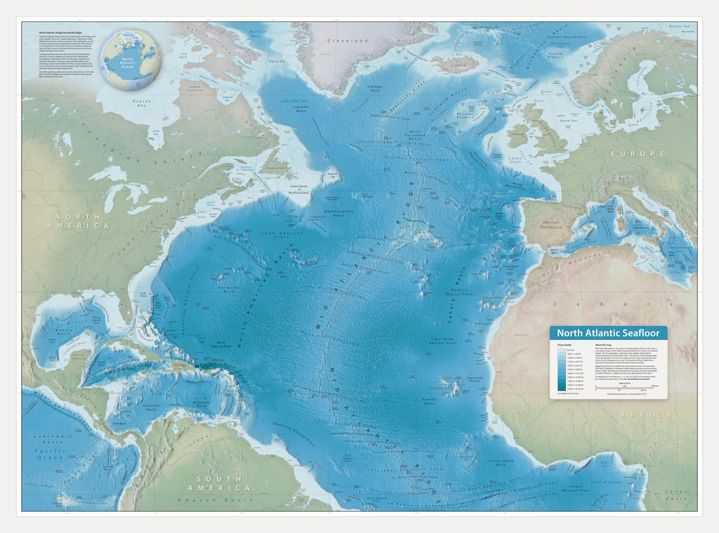
- This wall map showcases bottom features of the North Atlantic Ocean, including abyssal plains, banks, canyons, seamounts, trenches, and the scar-like Mid-Atlantic Ridge. On land, the map offers select coastal cities for reference. Blue Earth Bathymetry is the source of all topography shown on the map. It is an edited version of the GEBCO (General Bathymetric Chart of the Oceans) dataset. The 3D topography, rendered as plan oblique relief, depicts undersea features in partial profile with 1,100 percent vertical exaggeration. The GEBCO Gazetteer of Undersea Feature Names was the source for ocean bottom labels. Standard Matte Paper (Archival Map Print) Printed on our standard high-quality matte paper, this option offers excellent color accuracy and fine detail with a smooth, non-reflective finish. The matte surface minimizes glare, making it ideal for reading, studying, and framing under glass. FSC-certified and well-suited for both wall display and frequent reference. Best for: Everyday wall maps, educational use, libraries, offices, and framing.
- Subtype: Wall Art
- Language: English
- Folded Size: N/A
- Unfolded Size: 41" (W) x 30.4" (H)