Tom Patterson Maps
North Atlantic Seafloor - Laminated
North Atlantic Seafloor - Laminated
Regular price
$30.00 USD
Regular price
Sale price
$30.00 USD
Unit price
per
Shipping calculated at checkout.
Couldn't load pickup availability
- SKU: PODTP_N_ATL_SEA_LAM
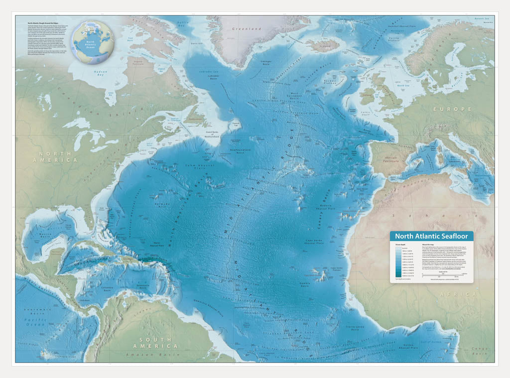
- This wall map showcases bottom features of the North Atlantic Ocean, including abyssal plains, banks, canyons, seamounts, trenches, and the scar-like Mid-Atlantic Ridge. On land, the map offers select coastal cities for reference. Blue Earth Bathymetry is the source of all topography shown on the map. It is an edited version of the GEBCO (General Bathymetric Chart of the Oceans) dataset. The 3D topography, rendered as plan oblique relief, depicts undersea features in partial profile with 1,100 percent vertical exaggeration. The GEBCO Gazetteer of Undersea Feature Names was the source for ocean bottom labels. Gloss Laminated Paper (Durable, High-Impact Finish) This option begins with our standard matte paper and is finished with a professional gloss laminate. The lamination enhances color vibrancy and contrast while adding durability and moisture resistance. The glossy surface is easy to wipe clean and helps protect the map from handling, making it ideal for long-term use. Best for: Classrooms, public spaces, field use, planning environments, and high-traffic areas.
- Subtype: Wall Art
- Language: English
- Folded Size: N/A
- Unfolded Size: 41" (W) x 30.4" (H)