USSR Ministry of Defense
Norfolk, Portsmouth, VA 2 (USA) - Soviet Military City Plans
Norfolk, Portsmouth, VA 2 (USA) - Soviet Military City Plans
Regular price
$49.95 USD
Regular price
Sale price
$49.95 USD
Unit price
per
Shipping calculated at checkout.
Couldn't load pickup availability
- SKU: SUAA-NORFOLK2-P
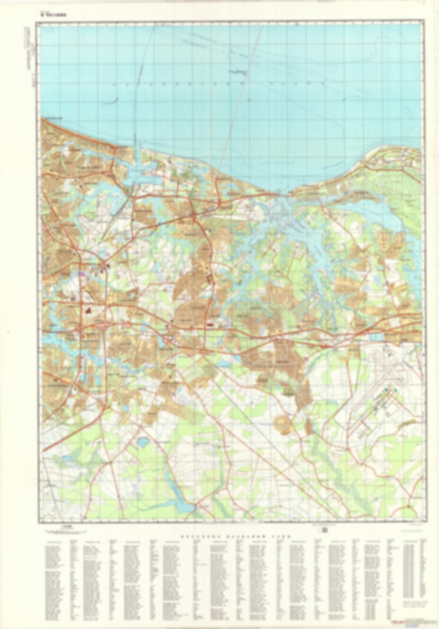
- During the Cold War and before easy access to high-resolution satellite imagery, The Soviet Military was secretly mapping the entire world. These aesthetically striking maps are beautiful down to the last detail and fantastic wall art and until now, have rarely been viewed or available to outsiders. This series has been covered by Wired Magazine and Greg Miller in his book, "All Over the Map: A Cartographic Odyssey". This map is part of the Soviet City Plans Series presented by East View, which has the largest collection of Soviet Military City Plans in the world. The Soviet Military City Plan(s) of Norfolk, Portsmouth, VA 2 (USA) is one in a series of highly detailed topographic city maps developed by the USSR Ministry of Defense during the Cold War era. These collectable, high resolution print-on-demand editions are delivered on premium, acid-free, matte paper. This item is sheet number 2 in a set of 2 sheet(s) for Norfolk, Portsmouth, VA Populated Places: City of Norfolk, City of Virginia Beach Military and Defense: Fort Story, Naval Air Station Oceanna, Naval Amphibious Base Little Creek Landmarks and Natural Features: Avery Island, Bare Point, Cape Henry, Caraway Point, Carter Point, Church Point, Eagles Nest Point, Fish House Island, Grassy Point, Great Neck, Great Neck Point, Hill Point, Hog Pen Neck, Humes Island, Linkhorn Point, Little Neck, Log House Point, Mapps Point, Mount Trashmore, North Thimble Island, Pleasure House Point (historical), Pleasure House Point, Sandy Point, Smith Point, South Thimble Island, Trants Point, West Point, White Hill, Witch Duck Point, Wolfsnare Point Water Bodies: Broad Bay, Brock Cove, Brown Cove, Deary Cove, Desert Cove, Dey Cove, Fishermans Cove, Kings Lake, Lake Edward, Lake Joyce, Lake Pleasure House, Lake Smith, Lake Taylor, Lake Whitehurst, Little Creek Reservoir, Lynnhaven Bay, Lynnhaven Inlet, Meadow Lake, North Auxiliary Channel, Sandee Lake, South Auxiliary Channel, Stumpy Lake, Thimble Shoal Channel, Varian Lake, White Hill Lake
- Subtype: City Plan
- Language: Russian
- Publication Date: 1975-06-01
- Scale: 1:25,000
- Countries Covered: United States
- MPN: NORFOLK2
- Folded Size: N/A
- Unfolded Size: 36.4" (W) x 52.2" (H)
- Weight: 4.8 oz