USSR Ministry of Defense
Newport News and Hampton, VA 2 (USA) - Soviet Military City Plans
Newport News and Hampton, VA 2 (USA) - Soviet Military City Plans
Regular price
$49.95 USD
Regular price
Sale price
$49.95 USD
Unit price
per
Shipping calculated at checkout.
Couldn't load pickup availability
- SKU: SUAA-NEWPORTNEWS2-P
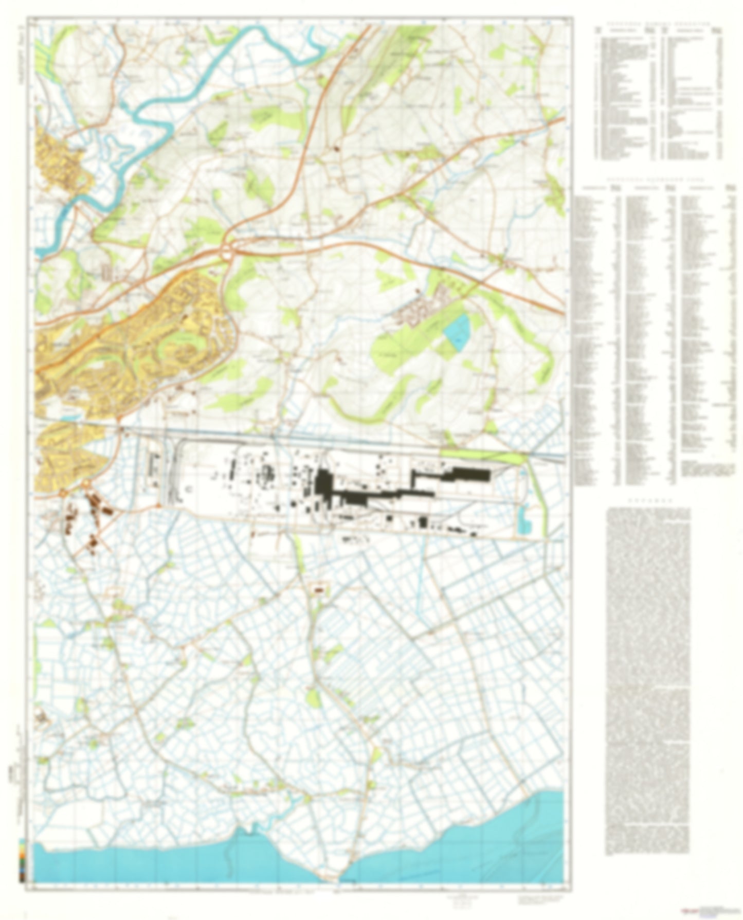
- During the Cold War and before easy access to high-resolution satellite imagery, The Soviet Military was secretly mapping the entire world. These aesthetically striking maps are beautiful down to the last detail and fantastic wall art and until now, have rarely been viewed or available to outsiders. This series has been covered by Wired Magazine and Greg Miller in his book, "All Over the Map: A Cartographic Odyssey". This map is part of the Soviet City Plans Series presented by East View, which has the largest collection of Soviet Military City Plans in the world. The Soviet Military City Plan(s) of Newport News and Hampton, VA 2 (USA) is one in a series of highly detailed topographic city maps developed by the USSR Ministry of Defense during the Cold War era. These collectable, high resolution print-on-demand editions are delivered on premium, acid-free, matte paper. This item is sheet number 2 in a set of 2 sheet(s) for Newport News and Hampton, VA Populated Places: City of Hampton, City of Poquoson Military and Defense: Fort Monroe, Langley Air Force Base, Naval Station Norfolk Parks and Reservations: Drum Island Flats, Hampton Flats Landmarks and Natural Features: Bay Point, Blacksnake Island, Cedar Point, Cedar Point, Cow Island, Dandy Point, Drum Point, Grunland Point, Hunts Neck, Hunts Point, Marsh Island, Marsh Point, Marsh Point, Messick Point, Northend Point, Oak Island, Old Point Comfort, Pasture Neck, Plumtree Island, Plumtree Point, Sewells Point, Sheep Island, Stony Point, Tabbs Point, Tin Shell Point, Ware Stick Point, Whalebone Island, Willoughby Beach, Willoughby Point, Willoughby Spit, Windmill Point, York Point Water Bodies: Back Cove, Bells Oyster Gut, Easton Cove, Entrance Reach, Fire Pine Creek, Flat Gut, Floods Hole, Floyds Bay, Front Cove, Hampton Roads, Lake Hampton, Lloyd Bay, Lynnhaven Lake, Newport News Channel, Sandy Bay, Thorofare Creek, White House Cove, Willoughby Bay
- Subtype: City Plan
- Language: Russian
- Publication Date: 1975-06-01
- Scale: 1:25,000
- Countries Covered: United States
- MPN: NEWPORTNEWS2
- Folded Size: N/A
- Unfolded Size: 36.1" (W) x 49.1" (H)
- Weight: 4.8 oz